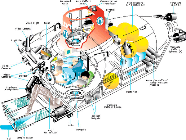
Schematic diagram of the DSV Alvin from the Ocean Explorer (NOAA) website.
More like this
I don't know if you guys caught the comment below from Bruce Strickrott, Chief Pilot of the DSV Alvin. We have been trying to get this guy to write something for Deep Sea News for about a year now. Why?
Did you ever look at Google's digital Earth model and notice something missing? Like 70% of Earth's topography, for instance? The seafloor shown there is a kind of "shadow topography". It's satellite derived.