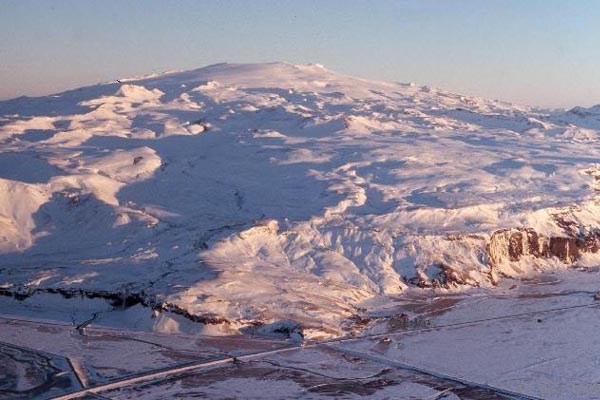
Eyjafjallajökull, an ice-capped volcano in Iceland that last erupted in 1823.
We talked a few weeks ago of signs that there were increasing signs that an eruption could occur on Iceland - increased seismicity on the Reykjanes Ridge suggested that magma might be on the move. Now, we have two pieces of evidence that we might see activity at Eyjafjallajökull, on the southern side of the island nation.
First off, there is a focus of seismicity under the area of Eyjafjallajökull, with an especially large bump in the last 2 days. Both the number and magnitude of the seismicity has been marching upwards, with the latest earthquakes reaching around M3, almost directly underneath the buried (by ice) crater of the volcano. This would suggest that something is up under the ice cap - either magma is moving in the system or the hydrothermal system is experiencing some large fluid flow event. I can't really figure out the depths of these earthquakes based on the Icelandic Met Office page, so any help with that would be greatly appreciated. UPDATE: The depths can be found by clicking the tab above the map marked "table". (Thanks to Bernd for that info.)
Secondly, from what I can gather from a Google Translation of an Icelandic article, there is also signs of inflation at Eyjafjallajökull. The article seems to suggest that the volcano has seen ~40 mm of movement/inflation to the south based on GPS measurements and that the focus of seismicity (when the article was written) was ~10 km below the surface of the volcano. (And any of you Icelandic readers, I'd love to get a better translation!) This would also suggest that magma might be entering the upper echelons of Eyjafjallajökull's magmatic system. UPDATE: It appears that the Icelandic Met Office doesn't think this is leading to an eruption (Thanks to Orri with help on the translation).
Taken together, it looks like Eyjafjallajökull is a prime candidate for the next eruption on Iceland. Eyjafjallajökull (also known as merely Eyjafjöll) is one of a series of volcano systems on the south side of Iceland, near Katla. Amongst the Icelandic volcanoes, it has been relatively quiet, with the last known eruption occurring from 1821 until 1823, with evidence for eruptions in 1612 and 550 AD. The last two eruptions have been VEI 2, with explosive characteristics - and with a volcano under a glacier, we always have the threat of jökulhlaup - glacial outburst flows triggered by the volcanic eruption. And unlike many Icelandic volcanoes, the last eruption of Eyjafjallajökull was produced silicic to intermediate tephra rather than basalt. The larger volcanoes on Iceland such as Eyjafjallajökull, Katla and Krafla have all produced rhyolite eruptions in the dominantly basaltic land - and the rhyolite magma that was hit while drilling last year shows that you can get very silicic magmas even in a hot spot/mid-ocean ridge setting.
{Hat tip to Dr. Boris Behncke and Mattias Larsson for info in this post.}
@Frankill, Jon, thanks for answering. 3:10am?! Gooood Morning Belgium! It is now 7:42 daylight savings time in CA Monday night.
@Passerby, thanks for concurring with Mammoth. What is the Alpide Belt? I meant to ask that before.
BTW, I know magnetic anomalies (thanks for correct spelling LOL) are not affecting Eyjaf. I was just throwing that in there just to just kid around a bit.
Anyway, could magnetic anomalies affect faults at all? Serious, honest question here. I have no idea if they affect anything, let alone earth movement. So called earth tides do move the earth up and down, but it is so small you can't feel it and apparently it doesn't amount to anything. Just an interesting feature.
I will check the quake maps you suggested and see what kind of pattern there is. I will say Mammoth is unique in a way because of the amount of CO2 (with the exception of Etna, Mona Loa, Kilauea, Yellowstone, etal) being released from the ground in so many places. I just seeps up from the depths and they think there is a large reservoir of CO2 there. "Danger, danger, Will Robinson!" (Sorry. I am in a dinggy mood tonight. LOL)
See Wiki page, Alpide belt. Note that before the Chile earthquake at the end of February, there was quite a bit of activity at the SE end of this belt. Interesting to watch activity propagate in a NW steps across Asia/Eurasia, also up the China coast.
There is, mechanistically, much more going on in these earthquake chain events, but heavy rainfall may be one of the triggers.
@Peter well you just have to keep them open a bit longer.
@James Get well soon. no time to have a cold right now.
I wonder how long this peak will last.
What is it that makes highly educated men persist in the belief that we are seeing glacier-related events just because there is a similarity in the earthquake signature? We're talking of events that occur deep inside rock, several kilometres (ditto miles for those thinking in feet and miles) BELOW the glacier.
If there is a similarity in earthquake signature, isn't it more logical that there are similarities between the behaviour of magma in rock and the conditions at the bottom of a glacier than that either the instruments or their operators are incapable of recording depth with any sort of accuracy or that Eyjafjall, contrary to known facts, has a glacier-filled caldera 2½ km (1½ miles) wide by 10km (6mi) deep?
I just went to the trouble of plotting the last 24 hours activity in Excel to get a simple chart with depth on the y axis and time on the x axis.
There is a very clear pattern that I suspect is also evident in the other cycles we have seen. The main focus of the first burst of activity is very definitely based at about 8.5 km depth. This lasted about 6 hours before it started to wane and activity became focused at 5 km depth which has gone on now for about another 5 hours. A third band of activity is quite stubbornly located at 1 km but the frequency at this depth seems to mirror what is happening at deeper levels without showing any clear pattern of its own.
Based on this, I think the shallow quakes (sub 5 km are probably simply a surface expression of strain at lower depths, possibly also the odd ice fall also caused by the tremors).
Looking at socuel's 3d plot again, there seems to be a very clear EW line running through the middle. Remember that this graph shows mean depth so there may be just as many shallow quakes here as to the north and south where the plot shades to violet.
My guess is we are witnessing some shifting along the fault line on which Ejya is based that is maybe either caused by magma intrusion at deeper levels or, alternatively, is facilitating magma intrusion. How high the magma has reached is beyond me I'm afraid!!
It would be great to get a seismologist in here to tell us about whether this pattern is symptomatic of coulomb stress patterns or something like that
(to get a rough idea of coulomb stress patterns see this 15 sec. youtube vid:
http://www.youtube.com/watch?v=qAmcVZbnAKc&feature=youtube_gdata
Socuel, you could certainly do a much better job than me of plotting depth on the y axis (inverted with ground level at the top) and time on the x-axis for the others to look at. I think it is quite instructive!)
Looking through the IMO table for Mýrdalsjökull, there are a few quakes that are anomalous due to depth. There is one at 0.1 km, one at 0.4 km, two at 0.5km, one at 0.6 km, one at 0.9km, one at 1.0 km 47 at 1.1 km and about twenty at 1.2 - 1.9 km. These quakes could be interpreted as having something to do with the glacier.
Certainly the seven quakes at 1.0 km or less are best explained by glacially associated events. The relatively large number of quakes at 1.1 km, 47, suggest some sort of boundary layer interaction - ice/water/rock. The 20-odd events between 1.2 and 1.9 km could be glacially related, but the rest occur at such depth that they can have no direct link to the glaciers. However, "correlation is not causation"?
@Bruce 506 So the upstroke of a spike are deep EQS, 8.8km. On basis that cause precedes effect I dont see ice as being an explanation of the oscillation:
@Henrik 505 I agree.
What could initiate each oscillation at that depth? In a roughly daily cycle?
I find it very puzzling that there is no trend in EQ magnitude. No larger EQs at depth to trigger each spike, nothing to suggest mechanism is changing with depth.
@Bruce Can you superimpose the tremors onto your plot? Are tremors coincident with deep or shallow EQs? If tremors reflect water/steam you might get a clue there.
It takes me around 1hour to get this web page to work after freezing many times. So I cannot respond as soon as I'd like.
Hi Peter,
I'm sorry you're not talking to a numbers type of person here.. It was quite a feat for me just to get the Excel charts to work!!
That said, there are some interesting features going on at the moment. Notice that current arc of quakes to the North of the volcano (63.7°N 19.6°W)? All of those are shallow and around M1 to M1.5. If you look at Google Earth they are just north of the scarp forming the northern edge of the volcano and about 2 km north of the icecap. I imagine this is normal fault slippage and unrelated to ice movement (too linear, too far from the ice cap) unless of course, one extends ice to mean isostatic rebound from a melting icecap.
@Bruce:
Signs point to there being an intrusion at depth, yeah. That's what the guys in charge of monitoring the situation believed as of Friday, anyway.
One big chunk of evidence for this was GPS readings, a lot of which aren't available on the IMO website. There are a lot more GPS receivers and seismometers deployed in the area which are not shown on the site. There are seismometers at a good distance away from Eyjafjallajokull which are starting to show movement away from the earthquake source, too, and the movement gradually increases as you get closer to the source.
It being measurable so far away is quite indicitive of a deep intrusion - a substantial shallow intrusion would perhaps shows stronger deformation closer to the source, but it wouldn't show up so far away.
This might be useful:
http://666kb.com/i/bhjf4ob7ghdmopulg.jpg
last 3 days
depth axis stretched by factor 2.
Size of symbols correspond to magnitude, color to depth
@James - sorry, guess I was being a bit misleading there. I didn't mean to discount magma movement being the source for the activity. All I meant was that a lot of the seismic activity might be caused by a deep body of magma upwelling at the mantle crust boundary (as in fact posited in the V Islands paper) and not necessarily be indicative of magma being close to the surface.
So, what I would love to know is if the scientists have any idea of where the magma is now located. Is it (just!) a rising plume pushing under the crust and all of this seismic activity is due to dilational movement pushing on known fault lines or has the intrusion penetrated deeper into the crust (as the enormous amount of activity at 8 km depth seems to suggest) or what?
On top of this is Peter's fascination with the periodicity of the activity and what sort of mechanism is causing this.
Personally, I still favor the notion that a magma chamber or sill is forming at the zone of low activity (5 - 6.5 km roughly - magma being ductile) and each cycle of activity indicates the arrival of a fresh pulse of magma from below. I suspect the shallower earthquake activity represents ground movement to accommodate the extra pressure in the magma chamber directly beneath it or wider strains and tension from the dilational effect of the plume.
Thus activity at 8 km depth represents the arrival of fresh magma from below fracturing the first brittle layers of crust before it reaches the sill. This could explain the transition of activity from 8 km to 5 km depth I saw in this last cycle (though activity has since moved back down to 14 km, perhaps as a new cycle starts)
@ Korf! Brilliant! I owe you a crate of beer. Just what I was wanting to see!
First impressions:
1. this does not look like a dilational pattern to me but a strong vertical plume!
2. I can't see any obvious zone of low activity that would indicate a ductile body of magma (or at least no large one!)
3. Nor can I see any obvious extension along a fault line although from the perspective (SE looking NW) we are kind of looking along it I guess.
4. Wow.
5. I just threw all my theories out the window (again lol).
@James, There are many sensors close to Eyjafjallajökull now and there number is growing by the day I guess.
I have noticed the movement away from the earthquakes on my geophone at ~40 km distance. But that change is not huge, only 1 to 2 km at most. There is a intrusion event taking place. But that might well just be a start of a eruption in Eyjafjallajökull. I am however waiting for a mag 4 to 5 earthquake that shows that the magma chamber has broken and the magma is on it's way up. So far that has not happened.
Korf, can you please rescale of the lat-long axes to focus graph resolution within Eyjaf? May help us see signal distribution patterns.
Very nice work, sir. Thank-you for your help.
@Bruce:
Maybe I could have phrased my post better - this cold is messing with my head...
When I said 'there is an intrusion at depth', I mean more than the current intrusion is a deep one. That's what the folks at the University of Iceland seemed to believe on Friday, going on the GPS measurements they were getting.
Maybe there is some movement at shallower depths too, but my guess is that it would be somewhat masked by the deep intrusion. Sounds like the bulk of the activity right now is deep, though. Therefore most of the seismic activity we're seeing here could well be rock fracturing as it is pushed upwards by the deep magma.
Certainly I am not ruling out the possibility of an eruption here - I'd like to see one, honestly, as long as it wasn't too bad - but I think *right now* the magma isn't sitting right below the surface. We may have a while to wait yet, unless this sudden increase in the last day or so is indicitive of some massive change in the system...
Thanks for the beer!
OK new version: 20x20x15 km. All axes same scale (no stretching)
http://666kb.com/i/bhjjgvgx4bayjzvvo.gif
OK, now we are cooking with gas!
Expanded view *might* point to stress mechanisms, from bottom to top, chamber refill percolation, chamber, E-W trending sill intrusion and shallow fracturing with what maybe ice movement-meltwater-gas-rock interaction in the top km.
Superb, Korf! Way to go, buddy! Now, we need to be able to see a slightly different dataset graphic, one that shows us what may have been going on, mid-day March 13-15.
Then we can do eyeball comparisons to see if sense can be made of the ominous lull before the burst of signals with depth change.
If you will please, sir, work your magic again, we would be grateful.
Btw, you can now clearly see the arcing curves (Peter's observation) of stress propagation along discrete horizontal layers vertical fracture paths.
I think this fits his description of much needed 3-D imaging.
@Korf, Can you please use the reviewed data. The automatic data can be off. I would also like to know how to make this type of plot.
I have been watching listening and learning. I have also been watching the MODIS site. Does anyone else see a plume in the following? am i looking at the proper location?
http://rapidfire.sci.gsfc.nasa.gov/subsets/?subset=Iceland.2010066.terr…
If 'Korf' is Dr. Richard Korf, Professor of Computer Science, UCLA and AAAI fellow, then we are honored and delighted to have your assistance here, sir.
Over 1,000 microquakes now in the last 48 hours.
Given the lull yesterday, that is a very sharp rise indeed.
No sign of M > 3 quakes yet.
Ha! @Korf with a bit of luck you might be close enough to where I live to pull this off. here's my email address:
brucestoutATt-onlineDOTde
@Jón Where are the reviewed data? Sorry, I did not read all of the >500 posts. The Software is SigmaPlot. The graph is done with some tricks- even too tricky for the software, as it drives it into crash regularly.
@ Korf. Wonderful. Just taken me an hour to get onto site, nearly gave up. Rewarded by terrific plot. Many thanks.
Korf, I wonder if those points were colour coded for time, if Bruce's rising EQs would become apparent? I'd expect to see the deeper EQs codeing earlier. Maybe use just the last spike as it has enough data points to visualise a pattern.
Yet another suggestion for oscillation. Assume daily cycle is mere conincidence, ignore moon, sun etc.
Envisage tubular structure eg conduit almost filled with fluid magma, but capped with compressible gas and or steam.
Once set in motion vertically the magma column could oscillate, bouncing off the gas cap, which is compressed and repels the magma. At peak pressure gas is forced into rock fissures , cracking with M1 M2 Eqs (30 to 300pound TNT).And generating HF tremors- see esk plot.
Rock fractures propagate upwards- see Bruce's analysis.
As top of column steadily rises (maybe by 2km mean depth rise in past week? ( Socuels'plot)} it encounters more wet rock, more steam generated, so sustaining the cycle despite gas leakage, and maybe accounting for the bigger peaks we have just seen. Although magma column would have, I think, a sinusoidal oscillation (sine wave) the EQs would be triggered as pressure rises, hence as column rises,but ceasing rapidly when pressure peaks, all the weak faults having been triggered. So asymmetric spike of EQs results from sinsoidal magma. Could this also explain exponential rise in EQS at start of spike? maybe so if magma accelerates conduit, fastest at mid point.
But how deep would this 'oscillating magam column' have to be not to appear on Korfs or Socuels 3D plots?? Is that geologically possible?? And can magma move wihthout revealing its motion as EQS or tremors?? It has to be moving down,stop then come up during the relatively silent interval between spikes
@Bruce 512. Maybe a mantle plumelet oscillating?
Hope to speak again, connection permitting.
@Korf, You can find the reviewed data here, http://hraun.vedur.is/ja/viku/2010/vika_10/index.html#mark You press [Fyrri vika] for last week and [Næsta vika] for next week. The reviewed list is at [Skjálftalisti] on all the weeks.
The earthquake swarm seems to have dimmed a little. But that is not uncommon. It might well pick up like before. The current swarm is reaching March 5 levels it appears.
@all: thanks for the flowers, As I enjoyed following the discussion over the last week, I decided to give something back, which might put the sometimes really visionary discussion on a little better foundation. My Input will be limited over the next week, as there is a lot to do in my real field of work.
@Passerby: No, Korf is not my real name.
@bruce stout: is delivery to Kiel possible? ;)--No, in ernest, I'm happy with virtual beer.
@Peter Cobbold: The points are depth coded to give a visual clue (besides the projections on the XY, XZ- and YZ-planes) how they are arranged in space: deeper=redder.
Or, for even lower rigidity, a medium which changes phase under compression. IIRC the pressure and temperature are past the triple point for water, but there are lots of candidates which might go into and out of solution.
Thanks for the great plot Korf! It really makes a difference to see the earthquake distrubution in 3D. I hope you will have time to update this plot from time to time.
Btw, James 510, your info in GPS changes is welcome. I think you are right about the deep intrusion, at least is sounds possible.
In that case I think we might have earthquake activity for weeks, meiby several months before there is an eruption. In that case it will be an amazing opportunity to follow the different activities preceeding an eruption. I think the development might go through different stages that we can follow by studying the earthquake distribution and the GPS measurements. Especially the GPS stations will be interesting because they should show large changes, but not necessarily uccuring fast, in case of a large magma intrusion.
One great thing is that with all the great discussion here, I think we will have a good chance of guessing what is really happening down there!
Korf!
Thank you for that wonderful graphic depiction (I thought the first version was best btw)! Earlier today (#507), I pointed out the great number of quakes at exactly 1.1 km depth and it shows up very nicely in your graph. To my mind, it looks as if you have a rigid, 1.1 km thick layer which is pushed from below by the mountain swelling and producing a sort of ring fracture feature. Below that you have the column of magma propagating upwards with two "chambers". Right now, there seems to be a gap in activity between ~4 km and the 1.1 km boundary layer. My guess is that if the magma can breach that ~3 km gap, we will have an eruption. Since it's taken two weeks for the magma-induced activity to rise from ~9km to ~5km, with one week for the actual movement, that's the sort of time frame we're looking at - up to a week after the next upwards move begins.
Then again, the closer it gets to the surface, the less the resistance...
@ Korf 529.
Yes understood that.
I'd still be fascinated to see in your 3D plot if, in a single oscillation -such as happened in last 36hours- the deeper EQs occur earlier, shallower EQs later. Hence my suggestion to change colour coding of each spot to encode time elapsed since spike start to spike end.
A couple more suggestions for several more hours of your spare time.
Try putting all the data points onto your plot, since EQs began. It will look messy- we dont mind- but might reveal magma chamber as a'hole' where few EQs generated.
Try plotting (again for all data) only those EQs which occured during 'esk' tremors. Might reveal where steam assisted EQs happening. And conversely plot the rather fewer EQs occurring during tremor-quiet periods.
@DCSessions. You thinking of oscillations in fluidity? Would this require pressure to cycle? and/or temperature? If magam more liquid when under pressure, more likely to open up fractured rock. A bit like thixotropic material only pressure- rather than motion-dependent. That what you're getting at?
@James That GPS data - over roughly how big a area and height of uplift to date? I'm curious about volume of magma needed to do the lifting: I'm guessing its big. So is it not strange that were are not seeing many EQs over M2. And no low frequency tremors. Is a silent giant commonplace?
Also it seems unlikely to me that such a large volume could oscillate. Any signs of oscillations in that unpublished GPS data?!!!
Peter asks: You thinking of oscillations in fluidity (per DC Sessions spot-on comment on thermodynamic considerations of phase state and mineral solubility shifts with pressure).
Sessions has wisely reminded us that in this complex system, heat and pressure flux are key factors in magma intrusion dike/sill crystallization kinetics. Further complications are matrix depth with respect to ductility/brittleness response to principle and tensor stress.
We'll have to wait for the graph of relocated EQs to see if the plot agrees with previously suggested magma storage depth of 5-8km and sill emplacement. Pertinent publications have already described a pipelike magma channel and presence of ductile-brittle transition zone with activity concentration at ~10km depth.
@Peter:
I didn't see an exact map for the other stations, and I'm trying to remember back to Friday, but I seem to remember they were detecting GPS movement somewhere on the southern or even eastern side of Katla which could be directly attributed to Eyjafjallajokull - the movement had only been going on for a few days.
@James, The GPS station GOLA is moving east, and that is happening fast it seems.
http://hraun.vedur.is/ja/gps/predorb/golapred.html
At this juncture, we need a ISGPS primer so we can make sense of the GPS data
http://hraun.vedur.is/ja/englishweb/gps/agufm02/index.html
By the way, you can run the ISGPS data page
http://hraun.vedur.is/ja/gps.html
through Google, which will automatically offer a translation (brackets alongside the original page listing - just click on http//blahblabhblah [translate])
Two jewels of data nirvana emerge from this 2002 Meeting Presentation: the last big swarm event in 1999 shows particularly aggressive change in E and elevation changes for a couple of Eyjaf local sites (slide of total movement trends over several years). The next year, sites like SOHO dive and are the lowest on the chart.
Jest so happens that 1999-2000 had a major change in weather patterns, too: PDO cold phase finally kicked in. It was quite a bit colder in Iceland, if I recall correctly. Snowload accumulated.
The second jewel is reference pattern of GPS station movements. Apparently, GPS 'typical' patterns give hints of eruption. When things are heating up, stations within some distance of an erupting central volcano will change-up direction trends and POINT to the eruption center, like well-trained retrievers. Now that is good to know.
Not only is that fracture zone I mentioned awhile ago kick up in activity before an eruption (like Hekla in 2000), it also was really active in 2008. There's a link at the bottom of the GOLA GPS station webpage mentioned in the post above mine. Take a look at the pretty picture.
There is a story there. For one, 2008 is when the first phases of Hellsheidi thermal plant came fully on-line. But there is something else about the region that makes it a remarkable sentinel (responding to the Hekla eruption, as shown in the slide presentation).
We'll chat about that later.
@ Passerby, Jón, some great links! Thanks!
for some reason the English language GPS site doesn't plot any data, but the Icelandic ones work fine if you just pretend you can speak it. (I'm getting to love this language!). Long story short, THEY is moving very rapidly SW. In other words these two sites (which are very roughly about 12 km apart) have moved about 8 cm apart within the space of about one week. Vertical uplift is not pronounced at GOLA but currently stands at about 3 cm at THEY.
This surprises me a bit because I thought we would see more uplift at GOLA if this was deep mantle plume pushing up the entire surroundings. Coupled with Korf's graph it looks more to me like a rift/fissure type scenario with possibly a small amount of magma nearing the surface to the east of the caldera... (all conjecture served with a free bag of salt from here on in :-))
BTW Korf, Kiel is possibly a doer.. I have a colleague who works there.. or we put it on credit until I finally make a trip to the wonderfully sunny northern part of Germany.. whatever suits you best. The offer still stands!
@Bruce:
There have been a lot of studies into the Iceland mantle plume, and I believe they've pretty accurately mapped it. It presently lies beneath Vatnajokull glacier, to the east - basically feeding Grimsvotn and Bardarbunga at present.
I guess there could be a 'mantle plumelet' beneath Eyjafjallajokull, as someone proposed previously, but I'm not really familiar with that theory so I'll have to have a read around if I can find the time between catching up on work!
I'll see if I can dig up the paper in which they mapped the plume down to some depth, too.
Hi James, sorry I am misusing my terminology again. I don't mean a deep mantle plume (i.e. the hot spot scenario) I meant a plume from the mantle/crust boundary, so yes, exactly, a plumelet. But if you can find a link to that paper I'd be most grateful!!
What's your take on what's going on? Do you think magma is reaching shallower levels (like 3 km or less)?
@Bruce:
I think this is the paper I was thinking of, although it's longer than I remembered!
http://www.springerlink.com/content/k63287l556345053/fulltext.pdf
I saw a shorter article in a journal a couple of years ago about a more up-to-date study, including a really nice 3D image of the plume made from seismic imaging (if I remember correctly). This was the diagram, apparently from UC Sydney, but I can't find the original article and I can't even remember which journal I read it in to be honest. I'll have a better dig around when I get the time.
http://www.abc.net.au/science/news/img/Ice_plume.jpg
As for my take on what's going on, I'm not sure. I'm inclined to go with what the people closest to this think, which is that it's currently a deep intrusion. I wouldn't rule out the possibility of it carrying on, though. However, it certainly seems like magma is reaching shallower levels (maybe not 3km, but I don't know) - the degassing event surely hints at this, as does previous activity and the pattern of seismicity.
Eric,
Maybe you can put this thread under a button at your opening page!
It looks as if this discussion is not over and will continue for a long time!
Concur with R deHaan - but it needs to be broken into parts, by post date. I'm sure some readers quail at the notion of reading nearly 550 replies.
Graphed data is looking interesting again. Would really like to see the data graphed from March 3 - present, soucel, if your program can be changed from rolling to cumulative display.
It would also be a good habit if all posters here refer to a link to publish that link in the same posting.
Just for comfort.
Just enjoying the postings here making the best of it!
Thanks to all of you, great work.
http://666kb.com/i/bhkpkc33pf8skxjxg.gif
the last peak of EQs
Or try a messageboard... ;-) Whatever is the most convenient ;-) .
Hmm... I think it's too early to say what type of eruption is going to happen (if an eruption is going to happen at all, but I don't really doubt that with this kind of activity). Eyjafjallajökull has been known to produce explosive eruptions. Considering that an explosive scenario might happen, take into account the size of the footprint of what's going on. I remember Dave Harlow saying in the 1992 documentary on Pinatubo called 'In the path of a killer volcano' (a bit of a (too?) sensational title, but the documentary itself is really good) that the VDAP team that predicted the Pinatubo eruption of 1991 was really worried about a seismic footprint that had a diameter of 5 to 6 kilometers. Now I know that Pinatubo had produced enormous sheets of pyroclastic flow deposits prior to 1991, so there was extra reason to be concerned, but if Eyjafjallajökull has the potential of producing an explosive eruption, I wonder how the seismic footprint of that volcano might be related to a possible eruption.
Anyway: if it's going to be explosive or not, the current activity is indeed something worth all the comments spent on it so far. Nice red sunsets this summer ;-) ?
@ Passerby 544. I'd like to have both plots from Socuel: rolling and cumulative. Ideally I'd want control of time-constant too! - beggars cant be chosers.
That was a beautiful, nearly perfectly symmetrical 36-hour long spike. What does that signify?
Maybe once the oscillator hits its natural frequency we'll see constant frequency with ever increasing peak height? Then an eruption?Although I guess natural frequency of,say, a magma column in an ever-changing pipe will change with time.(Especially so if it has evolving fluidity: see 530).
I must say I never anticipated seeing such 'organised' behaviour in a volcano. It must be useful information for infering mechanism. Need to see its spatio-temporal structure: 3D scatter plot with time colour-coded.
Socuel's 3D EQplots suggest to me a steeply shelving linear paired structure, with two blue lines running above and southwest of, but parallel to, two deeper yellow (broken)bands. Could that EQ pattern reflected a small section of wall of an old caldera of large diameter relative to Eyjaf? @Socuel: Would be interesting to see larger area mapped using all EQs to date. Does the linear EQ pattern extend out around Myrdals?
@ Bruce Stout, Korf and whoever is interested: why not combine drinking some beers at the Vulkan Brauhaus in Mendig with a nice excursion to the East Eifel ;-) ? A lot closer from Stuttgart, and probably a lot more fascinating to us than Kiel ;-) . I have to be a lot in the Eifel anyway during the next few months.
Btw... I haven't seen Boris Behncke here in a while? I'm sure posting here is not his main concern, but I'm still very interested in what he has to say on the Eyjafjallajökull matter ^_^ .
@Gijs, I think Boris has been monitoring here because he did post under the Mystery Volcano pic Erik put up.
@Korf, you sure gave us great graphs and it helped me a lot to see what has been going on. Big cudos there.
I have a suggestion for a temporary place to start a new thread and that is under the Spring Break open thread. Maybe we can refer back to here if we need to. Just a thought.
Boris might be preoccupied because Stromboli has been active with a little lava show.
Korf - Thank-you for posting the 3-D narrow time-slice of the last of the long valley and last big peak in event number. Sure looks like a deeper initiation, with an upward path of signal migration that is slanted ~20 deg and perhaps shows two lateral structure (or stress migration) with some coupling with the neighboring glacier shallow subsurface (from soucels IMO map movie, a gem). His wire graph is useful is one remembers its cumulative.
The latest Korf plot is looking like this in an intrusion with sill(s). The question is whether it will become deeper seated or not. The data in this isn't relocated.
The danger of Eyjaf erupting lies in the the past history of coupled volcanic eruptions, with the worst scenario being Eyjaf erupts first and is followed by a strong eruption (VEI-4-6) from Katla months later.
Nightmarish karma.
The next step would be to plot those earthquakes in Korf graphs against time, and create a movie where the evolution is shown. It would be amazing! But it is probably very difficult to do. ;)
@ Korf 546 Terrific plot of that last symmetrical spike. I think I see a narrow, plate-like structure at 6-8km : a restriction separating two more bulbous patterns. I could see, if these were two magma chambers, the possibility of oscillatory flows between the two.
As Mattias Larsson 552 says a repeat of that plot but with spots colour coded for time since spike started would be wonderful. You might find rupture sequences. If that looks a messy I'd suggest using the data from one of the sharp spikelets that occurred during the peak.
Can you software do this?:
http://en.wikipedia.org/wiki/Stereoscopy#Freeviewing
First, kudos to the host and his patrons, this place is awesome! Just a quick question, tonight there was a quake of 1.1 at 17:50:22 which was (non-reviewed) at a depth of 34.1km. For this episode, is that depth not a bit unusual?
I have not seen this depth recorded before.
For this data set, such a value lies at an extreme distance along the x-axis outside of the distribution of EQ depths versus frequency (y-axis). It's an 'outlier' and is considered to be statistically insignificant.
But you bring up a point: an analysis of rolling change in distribution profile might also be useful here, especially if it were to be compared to previous swarm events.
Passerby, thank you, totally understood that. I have noticed the swarm has taken towards an active period, so I will be reading.
Peter, there are graphics plotting packages for steroview generation (for instance, protein space-filling models, color-coded 3-D projections); Sigmplot doesn't appear capable of generating this type, but it can create rotating 3D projection displays that are better suited for our purposes- one can examine response surface projections in 4-space (x,y,z and time, with color coding for EQ magnitude).
I thought it was pretty slick when Korf used a map projection as the base of his graph cube.
Peter, color coding for time produces no visible pattern due to the overlap of symbols. I think Mattias' idea to animate it is tempting, but in the moment I have to resist any distraction. If anyone uses Sigmaplot I can email the template and the little script needed to color- and size-code the symbols and to produce the projections. I will contribute again next week. Finally a graph of all march events with smaller symbols, which therefore shows more fine structure.
http://666kb.com/i/bhlak9t2plluwdov8.jpg
That 'ordered' spike pattern: I got it! Each oscillation represents a roughly shperical, steadily rising, bubble of magma fusing with the structure that generates all the EQs. The time-course of that last spike gives it away. Its a roughly bell shaped curve.
It starts at 00 on 15 th as the sphere's uppermost cap joins the volcano's base. Small volume fused: low EQ rate.
Then as the sphere of magma continues to rise successively larger disc-shaped volumes (spherical segments) join each hour. The area of these rapidly rises (the radius of the discs expands rapidy), giving the rapid rate of EQ rise from
12 on 15th to about 00 on 16th.
Now the spherical segments become more uniform in size as the full diameter of the sphere is appoached and then engulfed. This continues during the plateau of the spike until around 15 on 16th.
Then the trailing hemisphere repeats the fast and slow falls of the curve.
Simple geometry equals simple pattern.
We could expect bubbles to recurr irregularly,and maybe with different sizes. But I would expect a bubble to be bigger if the delay since its predecessor was longer.And conversely, bubble size is less if they are more frequent. I think thats what the last ten days has shown.
@Socuel: could we see all the spikes on a single plot please?
Questions:
How fast do magma bubbles rise? How big would this one be, knowing it took 48hurs to fuse fully with deep base of Eyjaf's conduit? How do geologist know they occur? Is this old hat: have lab expts/in silico models etc shown this before. If so why are Eyjafs oscillations regarded as unusual?
Korf, that is a great plot. Thanks for doing it. It sure helps to see the pattern the quakes have followed for the month.
That 'ordered' spike pattern: I got it! Each oscillation represents a roughly shperical, steadily rising, bubble of magma fusing with the structure that generates all the EQs. The time-course of that last spike gives it away. Its a roughly bell shaped curve.
It starts at 00 on 15 th as the sphere's uppermost cap joins the volcano's base. Small volume fused: low EQ rate.
Then as the sphere of magma continues to rise successively larger disc-shaped volumes (spherical segments) join each hour. The area of these rapidly rises (the radius of the discs expands rapidy), giving the rapid rate of EQ rise from
12 on 15th to about 00 on 16th.
Now the spherical segments become more uniform in size as the full diameter of the sphere is appoached and then engulfed. This continues during the plateau of the spike until around 15 on 16th.
Then the trailing hemisphere repeats the fast and slow falls of the curve.
Simple geometry equals simple pattern.
We could expect bubbles to recurr irregularly,and maybe with different sizes. But I would expect a bubble to be bigger if the delay since its predecessor was longer.And conversely, bubble size is less if they are more frequent. I think thats what the last ten days has shown.
@Socuel: could we see all the spikes on a single plot please?
Questions:
How fast do magma bubbles rise? How big would this one be, knowing it took 48hurs to fuse fully with deep base of Eyjaf's conduit? How do geologist know they occur? Is this old hat: have lab expts/in silico models etc shown this before. If so why are Eyjafs oscillations regarded as unusual?
Peter! That is a very persuasive argument! By "the rapid rate of EQ rise (from
12 on 15th to about 00 on 16th)", do you mean the magnitude as the number of EQs are similar throughout the active periods?
Over the past few days(?) there seem to be clusters of EQs superimposed on this cycle of usually 3-5 quakes occurring within a timeframe of ~2 mins and at greatly varying depths (see Thursday 18/3 14.36.53-14.39.32, about 5.1 - 5.9 km SSW BASAR and at 13.9 to 4.8 km depth). Typically, these "swarms" seem to contain the largest quakes of the series you point out. Coincidence or common causation?
Apologies for frequency-doubled posting.
Ever the academic, I can see more mileage to be dragged out of 561. Can we extract predictive information from the bell- shaped peaks in the oscillator? Thus:
IF magma bubbles rise at constant velocity, then overall duration of each spike is proportional to its volume. BUT EQ numbers in each peak would not reflect the volume of the magma pulse per se, but would I suggest be proportional to the increased stressing of the magma chamber caused by the pulse of magma. So for a given volume (=duration) of spike we should see higher EQrate as the magma chamber begins to fill up to capacity.
@ Socuel: seeing full 12 days of your EQrate plot would very useful in this context.
Also if the number of EQs contained in each spike, and the duration of each spike were both plotted against time(eg of mid-peak) we might see a divergence of the curves, with EQnumber accelerating faster than pulse duration as the chamber fills.
PS IMO's 2-minute EQ map US. Is it just me?
Changing tack slightly, how high has the magma reached by now and how long can the remaining layers of rock resist penetration? Perhaps a little "cross-pollination" from another field can provide some insights? I'm a retired Army officer and my speciality was infantry anti-tank weapons. When we consider armour plate resistance to projectile penetration at velocities below ~1200m/s, only the middle part of the armour plate resists. If a plate is, say, three inches thick, only the middle ~2 inches of the circle corresponding to the projectile circumference resists. The ~½" closest to and the ~½" farthest from the projectile contribute little to armour plate resistance to penetration. (Numbers VERY approximate, depend on Brinell hardness of the plate, projectile velocity, composition and obliqueness of impact.)
Could we look at Eyjafjall in a similar way? From the EQ data, it would SEEM that magma has reached the 4½ km level and there seems to be a permeable layer at 1.1 km depth. This leaves ~3.4 km to resist the magma penetrator. Of this, it is the middle ~2½ km that provide the resistance. Can we see any evidence of this in the EQ data? Putatively, this hypothesis would predict an almost "earthquake-free" zone (as EQs are a sign of rock fracturing) from, again very approximately, 4 to 1.6 km depth. Quickly looking through the data, there seem to be few EQs in this zone. What say you?
PS. Found a picture of Eyjafjall from the south which shows the main crater and the lesser "peak" to the ENE (right) of it, under which activity seems to be centered. IF an eruptions occurs, it will be interesting to see if it is where this "bump" is or elsewhere and compare views.
http://static.panoramio.com/photos/original/5531670.jpg
Forgot to add:
The picture - http://static.panoramio.com/photos/original/5531670.jpg - also shows the extensive agricultural area below the volcano which is now at risk. Let us not, caught up in our academic interest as we are, forget the people whose lives will suffer major changes if an eruption occurs!
Visco-elastic magma - Bubble growth dynamics and implications to explosive eruptions due to magma fragmentation. Ittai Kurzon
(abstracted from a seminar given last week at an Israeli Institute of Physics)
'Our model provides all the elastic components (stresses, strains and strain rates) required for defining criteria for failure and magma fragmentation. We suggest two failure criteria, a stress related criteria based on the internal friction and the Mohr-Coulomb failure theory, and a strain related criteria based on fibre elongation experiments. We argue that both criteria are equivalent if we consider their shear modulus dependency and its effect on magma rheolgy. '
You need a heavy duty shear stress source.
Maybe episodic untethering of the glacier (riding on meltwater pool) with jerky stress transitions in the layer beneath is causing bubbles closer to the surface.
We would need corresponding data (geolocation and tomography) correlating glacier release, movement and resettling in the time frame corresponding to, but shifted, to EQ signal stream periodicity.
More on magma gas bubbles:
No more troubles with magma bubbles: numerical simulations of gas dynamics in viscous magma (2009) AGU Fall Meeting 2008, abstract #V21B-2091.
'Gas bubbles in magma play a crucial role in eruption dynamics, particularly in basaltic volcanism. Here we examine the dynamics and stability of bubbles during their ascent in magmatic conduits through numerical simulations in both two and three dimensions.'
So maybe we are seeing release and fragmentation of magma *gas* bubbles, a notion not so far removed from Dianes' inquiry on fumarolic activity at Eyjaf.
Hard for me to see EQ signal structure that suggests magma gas bubbles, but whatever is going on, it's not typical of previous swarm events for this volcano. Indeed, signal density here is remarkable.
Well after all this discussion here I thought I should throw in a few considerations from a volcanologist who is actually dealing with a frequently active volcano, Mount Etna. Eyjafjallajökul is certainly a completely different issue, firstly because it's a system that has not erupted for >180 years, and that's a major contrast with the perpetually open system at Etna. Secondly, it is a different type of volcano, because it seems evolved - up to rhyolitic - magmas have played an important role in its history. Thirdly, it has a brief and sketchy record of historical eruptions.
Yet I think what we see in these days, from the seismic and ground deformation points of view, is definitely a restless magmatic system. That means, it looks really like it's magma on the move, not some external or superficial process - that would not cause all the seismic activity at several kilometers of depth and none of the quite impressive ground deformation we see. What is fascinating is that it is continuing for quite some time, though we should remember that strong seismic activity at Pinatubo in 1991 and St Helens in 1980 lasted for six, seven weeks in both cases before they erupted. That does not necessarily mean that we're seeing a similar eruption scenario here - it might turn out a non-eruption after all, or a small event.
I would avoid to draw very apocalyptic scenarios, I have heard of no volcano sector collapse being documented anywhere in Iceland (not even in the geological record), but certainly there is a high risk of glacier melting and flooding - jökulhlaups as this is called in the volcanological terminology, from an Icelandic word. So I don't think large tsunamis are much of an issue. If we take the huge eruption of Ãræfajökull in 1362, the largest explosive event in Iceland in historical time, this is known to have produced catastrophic glacier melting and flooding and numerous victims. That's the sort of eruption that I can indeed imagine at Eyjafjallajökull, only that this volcano is much smaller and has much less glacial ice on it than Ãræfajökull.
All in all this is an intriguing story going on, and certainly if we saw a similar seismicity at an Italian volcano there would be a lot of agitation among volcanologists, civil defense and the public. Let's wish this will not happen anytime soon, because here people do not have the same relaxed way of handling emergencies as they apparently do in Iceland. I am confident the Icelanders will handle this smoothly, I remember how calmly and efficiently they did the evacuation of Heimaey in 1973 when a new eruptive fissure opened just a few hundred meters away from the nearest homes.
A new MS-thesis:The Skerin ridge on Eyjafjallajökull, south Iceland: Morphology and magma-ice interaction in an ice-confined silicic fissure eruption - http://skemman.is/handle/1946/4375. It is possible to see more than the abstract by clicking on skoda/opna - shows how Eyjafjallajökull is as likely to
produce fissure eruptions as one big explosive from the central crater.
@ Peter
Love your input and continued fascination with the periodicity of the activity. It seems to becoming less periodic now, but there is still a discernible pattern.
I like the spherical body model: it seems to me too that the periodicity can be explained by a body of magma (with roughly the shape of a sphere) passing through a constricted passage in the conduit or undergoing some other fundamental change such as entering a sill or magma chamber / suddenly degassing etc.
Of these options I think I favor something going on with the gas in the magma. Were the sinus curve just a product of pressure caused by the ascending sphere of magma I think we could expect greater variation in the magnitude of the quakes with some pretty hefty ones happening when the sphere (and hence pressure) is at its peak flow (roundest) and mostly tiny ones at the beginning and end of the cycle. But we don't see so much a sinus curve in magnitude as much as we do in the number of quakes, i.e. whatever is causing the periodicity is not simply a waxing and waning of pressure per se which would lead to a similar waxing and waning of magnitude but its causing a waxing and waning in the frequency of similarly sized seismic events. This suggests to me a fractured substrate accomodating pulses of energy (either as steam or gas driven product from new magma) in a myriad number of similar events... what do you think?
@ Passerby, I think you are on to something with the water/gas thing but I still have problems with the isostatic rebound theory (less pressure from melting icecap causing greater melt and related exsolution of gases) I can kind of follow this line of argument but, like Henrik already asked, why is this not happening at other volcanoes with melting icecaps and active magma chambers sitting under them? ... or is it and we just don't know it yet? eek!!
Yikes! they are getting quite shallow. That last one was M2.8 at just 600m depth with 90% certainty. I reckon we are going to see a fissure eruption soon if this keeps up.
600m deep?
Yep.. this may be it...
I'm gonna be away yet again for this week-end, so if something interesting happens, I won't know before Monday.... unless it makes it on the news in France....
So.. either go for it now, or behave yourself and wait a few days, Eyjaf!
@Boris post 567
You write: "I have heard of no volcano sector collapse being documented anywhere in Iceland (not even in the geological record)". What do you mean by "sector collapse"? (Sorry if this has been discussed in earlier posts - I haven't been following the discussion to closely the last few days...) I'm also af volcanologist (though not working with the topic presently) - search for "Heidi" or "Tindfjalla" in earlier posts and you will se why I find the discussion interesting.
When I worked with my Thesis I heard speculations (or perhaps best called urban myths) that the neighbouring volcanoe Tindfjallajökull had been the highest point in Iceland until it blew its top in the eruption that produced the pyroclastic flow deposit that was the subject of my thesis. Would such an event classify as a "volcano sector collapse"?
Hi all,
I am following all your discussions since two weeks and I am am intrigued by all the different ideas, waht might be happening under Eyjafjallajökull currently. Does anybody know about papers, which describe comparable situations? The only one I've found so far is here on page 30: http://www.vedurstofan.is/media/vedurstofan/utgafa/skyrslur/2009/earthq… OK, the earthquakes have been recorded in a deeper area, but show simliar patterns. Or am I on a wrong track?
@Heidi,
Here is an example of a future sector collapse:
http://www.youtube.com/watch?v=Y0IgwVElUwE&feature=fvw
@Bruce571
That shallow Quake M2.8 (at 600m) seems to be deleted.
I saw it to but now it seems to be removed from the chart.
Peter, Passerby, and Bruce, I have read your posts and what I am seeing from what you are saying is that something like a mud pot is bubbling gas periodically and possibly creating the quake sequences. Thing is, it is magma and not mud. I have seen mud pot dynamics and right now I am wondering if magma can behave the same way deep down. It could be pushing up and when it hits a barrier, it bubbles the gases off and the pressure of that gas and magma creates the quakes. It would come in cycles like a mud pot does, only slower and much stronger.
I would like to hear your input on this.
Boris, if you are reading things here, maybe you could also shed some light on magma behavior. I know a little bit, but not that much except that rhyolitic magma is more viscous than basaltic and my guess is that basaltic might behave more like a mud pot if it had a lot of gases in it. I have seen some movies of Halema'uma'u crater and the spattering. I would think rhyolitic would be more like mud, depending.
Anyway, I am just speculating here and you guys know way more than I do so I would love to hear what you have to say. I learn that way.
WELL, some of the last part of that paragraph didn't make much sense, did it? LOL
What I meant to say is that I think rhyolitic may behave more like mud than basaltic because it is thicker. Basaltic magma seems to splash more, but it can have more silicic tendencies depending on where it is coming from, so the more silicic the magma is, the more it would behave like a mud pot if it has a lot of gases in it. Now does that make any sense? :-)
Bruce wrote:
..but I still have problems with the isostatic rebound theory (less pressure from melting icecap causing greater melt and related exsolution of gases) ..
Wrong perception. Ice mass does not change, pressure INCREASES with infiltration of melt-water into surface layers of rock, principle stress drops and shear stress increases as the glacier moves in s chatter-repetition with rock fracturing beneath. This might encourage gas and magma movement from below in conduits.
Peter's idea of gas bubbles made sense and then I threw in work that suggesting that sheer stress can break up both magma (releasing gas under pressure) and break up rising gas bubbles into many small ones, increasing effective bubble surface area and causing small poorly confined mini- quakes near the surface.
The only quake activity with this kind of periodicity that I could find was icequake related. That led to reading about subglacial pools and glacier attachment cycles, and that mechanism provided the shear stress source for breaking up magma, releasing gas and also breaking up gas bubbles at shallow depths (like passing a stick through a glass of large bubbles).
Now go back and look at Korfs 3D iamges.
Complex? Yes, many moving parts (causes, mechanisms). No simple answers, but at least it sort of make sense if you have that cyclic detach-reattach behavior at the glacier-base-rock interface that may catalyze periodic movement of magma and magma gases.
@ Boris 567 As an experienced volcanologist would you say these oscillations in EQ-rate are unique/unusual? Or maybe widespread but never recorded; detected here only because of presence of permanent seismometer array?
@ Bruce 569. Thanks Bruce, I'm convinced those oscillations carry information within them, albeit hidden! I'm more focussed now on the roughly consistent time-course of each spike rather than the periodicity. The idea of a sherical magma bubble inducing a bell-shaped EQcurve is based upon the bubble fusing with a planar surface larger than its diameter. In the situation you envisage where a magma bubble is ascending a tube smaller than its diameter I'd expect the curve to start much as we see but then soon plateauing at a lower peak EQrate for a long period before falling off.(given the same bubble volume). The long plateau reflects the time spent squeezing up the bore, where the bubble is forced into a constant diameter torpedo shape. Indeed were the shape of the spikes to thus change, it might reflect a change in bubble-fusing site, from planar to tubular...could be useful.
What I envisage to explain the bell-shaped spikes is an inverted funnel below a conduit feeding the base of Korf's 3D structure. All are filled with buoyant but viscous magma. At the base of the conduit the inverted funnel (formed in the under-surface of crust?) is part-filled with the same buoyant magma. It is onto this planar surface that the rising bubbles of new buoyant magma fuse. The extra buoyancy generated by each bubble is tranmitted up the conduit to exert pressure, maybe quite uniformly on the EQ zone. I think this could explain why the EQS are so uniformly small. We must also explain why such a large uplift is happening over a much larger area than Eyjaf's centre. I'd suggest that the magma flow into Korf's structure could be relatively slow,and not the sole agent genaerating EQS. I see the uplift given by each bubble fusing with the funnel - over a considerably larger area than Eyjaf's active area, as the GPS indicates -as creating elastic strain and hence the opportunity for EQ generation by fracturing, asissted by the extra pressure from the conduit. That's how I get round your objection that EQ-magnitude is not greater when bubble first fuses.
I'd predict that the rate of uplift accelerates as each bubble fuses, but GPS appears to lack time resolution to see this.(Or is faster time-resolution GPS data being overlooked in a quest to shorten the daily error bars? Uggghh!-time is important!)
I see those magma bubbles, in total, as being comparable in volume to the uplift. Conceivably the funnel would be comparable in area to the uplifted area. These could be BIG bubbles. Can a geophysicist/rheologist make a stab at estimating the volume of a sherical bubble of magma that takes 48 hours to fuse with a planar layer. Ballpark obviously.
Wish I stood a chance of understanding Passerby's references, but school physics 50 years ago not up to task.
So I have to resort to hand waving. Its getting a bit lonely pushing the oscillations: where are all you geophysicists?
@Bruce,Passerby 566. I have not considered gas at all. By way of apology I'd claim that at the depth I imagine the funnel and conduit to be(10-20km?) gas remains in solution.
Peter Apologized..school physics 50 years ago not up to task.
*snort* Well, yeah, I knew you weren't thinking about magma gas, but it immediately came to mind, although the physics
You work in intercellular calcium signaling, you bathe in chemical physics. Granted, you are more likely to encounter principle body stress and shear stress planes in an elementary engineering mechanics class, than an undergrad physics class.
One way to know for sure if gas bubbles are a player in swarm tectonics would be to look for gas quench inclusion evidence in the volcanic glasses of previous eruptions. The physics *are* tricky: the degrassing conditions may be well away from equilibrium and limited because the quench pressure is much lower than the pressure exerted by glacier (of which meltwater intrusion into rock fractures is much lower in magnitude). In other words, there isn't much degassing in this highly constrained system..
But what if you temporarily reduce the pressure, allow it to be displaced when the glacier floats for short periods? That might be enough to encourage deeper magma degassing, gas bubble rise and at the same time apply that tremendous sheer force (nearly horizontal) from temporary, jerky glacier movements.
*shrug* I don't think this is a simple case of magma movement. Looking at sea surface temps (Thanks, NASA!) over the past few years reflected in a smart pace of temperate coastal marine glacier recession in Iceland and elsewhere, one realizes ice is probably part of the equation.
But there is yet more afoot, yet. Depends how Katla reacts. So far, it mostly looks like outlet glacier activity.
Peter, don't worry about your physics being some time ago. I didn't take HS physics. I did have some physics when I took electron microscopy. But it was basically HS physics and the second class was Electron Optics. Not exactly related to geology or volcanics.
It almost sounds like Passerby (correct me if I am wrong, Passerby), you and I are on a simular page regarding gas bubbles. I just don't use the same terminology. I ain't a PhD. :-)
I wonder what the Icelandic volcanologists think is happening. Oh well...
@heidi - re sector collapse, several of my posts gave citations to Cumbre Viejes projections, and those similarities I began looking at because deposits on the ocean floor just south of Eyjafjallajökull look suspiciously like the possible aftermath of either slope failure (ie. the southern flank) or a Mt. St. Helens-style eruptive side flank explosion... which several readers here believe the past two eruptions do not indicate could happen, but uncertain Holocene eruptive history does not clearly rule out.
The discussion has come back to this several times. James proposition that the strata may be weaker in off-caldera fissures and pipes (and hence may fail and erupt from the side rather from a more rigid, ice-burdened caldera)... plus the pre-existing large offshore debris deposits I discovered a few years back (one possibly 175 kilometres long)... suggest that occasionally a chunk of Eyjafjallajökull cracks open and slides off southward into the sea, similarly as outlined in the Simon Day and Bill McGuire papers I cited.
Use my name in page-search mode to locate those older posts of mine, for links to the full-paper pdf's.
@Peter , ha! you are not the only one having to resort to hand-waving!! Try participating here on the back of a career at translating designbook texts and financial reports.. lol
You are right though, IMO, gas probably doesn't play a role at the depths we are talking about but it is likely to be a factor at shallower depths where there will be interaction of ground water with hot magma and other volatiles will start to come out of solution. However, I would have thought this would have some kind of surface expression (fumaroles, glacial melt, etc.) that as far as I know, have NOT been reported yet.
As for the torpedo / tube vs. the sphere / planar interface model.. I kind of prefer the former. This might be based on my misunderstanding of the sine curve you see. If you look at Magnitude vs. time (Soceul 1) the curve is precisely this rise plateau sink curve (torpedo).. but I think you were focussing on the spikes (by spike, do you mean highest magnitude quakes or highest frequency?). Socuel 3 (mean number over time) displays some near-perfect sine waves which I think are still compatible with the torpedo analogy. The other problem I have with a planar interface is what this could be. Possibilites: the lower edge of a magma chamber (which would imply there is one, i.e. a discrete edge whose ingtegrity is breached and restored with each pulse of fresh magma), or maybe it is the mantle crust boundary (which is at 30 km I think in this region) or possibly the ductile/brittle boundary (postulated at 14 km I think).. hmm.. trying to get my head around that one... bear of very little brain and all that..
@Passerby.. Here too, I'll play the role of the dumb student (comes pretty naturally ;-)) and pose some questions:
You said: "Ice mass does not change, pressure INCREASES with infiltration of melt-water into surface layers of rock, principle stress drops and shear stress increases as the glacier moves in s chatter-repetition with rock fracturing beneath. This might encourage gas and magma movement from below in conduits."
Q's:
1. Why would pressure increase with glacial water infiltrating surface rocks? Wouldn't water, like any medium, only move from a high pressure zone to a low pressure zone? Is the increase in pressure because the water is heated (to steam maybe?)
2. When you talk about principal stress and shear stress.. (forgive my ignorance) are you talking about something like the surface tension of the bubbles? (pretty complex things, bubbles) - i.e. gases are exsolving from the magma, glacial melt water acts as an agent to break larger bubbles into smaller bubbles.. the vibrations from this bubble activity extend up to the glacier which wobbles in resonance (is that what you mean by s chatter repetition?) facilitating further penetration of water and further fragmentation of magmatic bubbles?
What I envisage from your passage is that melt water penetrates strata near magma body or close enough to it to heat up. The ensuing pressure causes vibration which in turn results in fairly constant jiggling of overlying glacier which encourages fracture of underlying strata (in conjunction with underground pressure). This constant jiggling facilitates upwards movement of buoyant magma body.... something like that?
3. If the above even half-way approximates what you mean (highly unlikely I'm afraid!!!) what is the mechanism causing the periodic attachment/reattachment of glacier to bedrock? If it were steam or gas emission I would expect to see melt sinks in the glacier or some other expression... or do you think this is just water lubrication (which I would have thought would be a permanent from the sheer weight of the ice alone)..
Excuse the long post!!
Good Morning, I noticed today that back in February of this year, Iceland's Penninsula had a bit of eq/swarm, which I found interesting. In fact one of the links that my search provided was to a discussion on this board about that particular activity.
Anyways, that led to the Article below, that suggests quite eerily that the activity may be described as a stress transfer. The article further asserts that indeed Eyjaf experienced a similar swarm just before the "SISZ" experienced it's last episode of large quakes. Any thoughts? If this was already discussed my appologies.
After 2000's quake Iceland's Met office suggested that there was a elevated chance of a 7.0m quake in the zone in the next 25yrs, can't remember exactly the odds given but it was substantial.
http://docs.google.com/viewer?a=v&q=cache:gCT0SeB1uIQJ:134.76.163.148:8…
Very interesting.
There is a peak in seismic activity going on right now all over the planet.
I can't remember a period where the number of registered quakes magnitude >= 4.0 at http://www.iris.edu/seismon/surpassed the number 500 in a period of 30 days.
Today we are close to the number of 700
No scientific conclusions, just observation!
The Assessment of the SISZ quakes of 2000 is where I read the probability or possibility of future activity there. Here is a snip from that paper. Note the article is a very good read as well.
"The moment released in these two earthquakes is 1.1Ã1019 Nm. The moment built up and released during 140 year earthquake cycles period has been estimated as 0.7-1Ã1020 Nm, the higher value based on estimated size of historical earthquakes. Assuming that the historical earthquake magnitudes have been overestimated and only 100 years have elapsed of the 140 year period, the moment build-up before the earthquakes would have been 4.6Ã1019 Nm. This still means that only a fourth of the stored moment would have been released in the two earthquakes. It is probable that what is left over of the moment is mostly stored in the easternmost part of the SISZ, where the largest earthquakes are to be expected as the elastic/brittle crust is thickest there.
Although all such results are uncertain because of the nature of the data which they are based on, it is probable that more is left over of moment in the SISZ than has been released in these earthquakes. The only one of the historical earthquakes that has an instrumentally based magnitude is the 1912 earthquake in the eastern part of the zone, with magnitude 7 (Ms). That earthquake [1] and the largest earthquake of 1896 (estimated magnitude 6.9 (Ms)) had considerably stronger surface fissure expressions than the recent earthquakes.
The build-up of strain since around 1900 up to year 2000 has not been enough for releasing an earthquake in the easternmost part of the zone, i.e. in the magnitude 7 range. It is probable that it will be released within a few decades to cope with what has been left over of moment after the recent earthquakes and what will be built up during next decades.
The above reasoning is based on a simple model of build-up of potential moment assuming steady plate motion across a homogeneous SISZ, however, with changing thickness of seismogenic crust, i.e. increasing from west to east. In this case the release of strain energy in earthquake episodes along the zone would preferably start in the east, but proceed in smaller, triggered earthquakes towards west. Although this has some support in history, both history and the recent events show deviations from such a model. It has been proposed that strain build-up for earthquakes is not only due to general plate motion, but has also a local build-up of stress, possibly caused by intrusion of fluids near the bottom of the seismogenic crust [12,13]. Considering this suggests that it is still possible in a near future that an earthquake of comparable size to the recent earthquakes will occur to the west of these in the SISZ, either before a magnitude 7 earthquake in the eastern part or following such an earthquake as a triggered shock. "\\\\\\\\\\
http://hraun.vedur.is/ja/skyrslur/June17and21_2000/index.html
The most interesting aspect I took out of the entire paper is that those quakes only released a 1/4 of the stress load and that it would be theoried that the next round would start east of the zone and then propagate eastward.
Stress transfer requires a source of stress. I think you are suggesting transfer from Eyjaf along the plate boundary fault zone connecting the two southern rift legs.
I suggest something different, that during this period of heightened geologic activity, man-made, large-scale subsurface disturbances are causing stress propagation between source and stress loaded volcanic centers.
IceNews, Earthquakes in Iceland, May 2009
Icelandâs south western Reykjanes Peninsula has been experiencing a huge amount of seismic activity in recent days.
438 earthquakes have occurred in the region (Southern Reykjanes Peninsula) in the last 48 hours alone. The biggest quakes happened at 21.33 last night and at 13.35 today. Last nightâs quake measured 4.9 on the Richter scale, and todayâs 4.5. ...No damage or injury has been reported anywhere and the quakes were much smaller than last Juneâs 6.3 tremor, which also killed no one.
The epicentre of this swarm was close to the geothermal power plants, Svartsengi and Reykjanes, on the tip of the Reykjanes peninsula.
Where there has been a recent uptick in seismic activity.
After the Kárahnjúkar Hydropower Project inundation (filling of a 5-dam reservoir) in 2007, there was a most unusual spike of activity, but at depth, near Askja volcano. The project was completed in 2009.
See: A Magmatic Origin for the 2007 Micro-Earthquake Swarms at Upptyppingar, Iceland? American Geophysical Union, Fall Meeting 2007, abstract #S43A-1037.
>Micro-seismicity is common within the rifting zones that intersect Iceland. However, between February and August 2007, anomalous swarms of tectonic earthquakes -- amounting to at least 3,350 epicentres -- have been detected over a 36 km2 area near to Upptyppingar (16.2° W; 65° N), which forms part of the Kverkfjokull volcano system, extending from the northern flank of the Vatnajokull ice cap. ...the Upptyppingar micro-earthquakes are noteworthy because (i) they concentrate at focal depths ranging from 15 to 18 km; (ii) the swarms comprise earthquakes <2 in magnitude; and (iii) several of the swarms originate at focal depths exceeding 18 km. Each swarm has been confined to a small surface area and focal depths have remained mostly consistent, both within and between swarms.
>Curiously, few earthquakes have been detected at shallow depths within the zone of unrest....Interestingly, the up-surge in seismicity from the Upptyppingar region coincides with the ongoing formation of a 2,000 GL reservoir for water, located 21 km south-east of Upptyppingar. Nevertheless, the possibility of induced seismicity remains unclear.
See: Earthquake swarms at Upptyppingar, north-east Iceland: A sign of magma intrusion? (2008) Studia Geophysica et Geodaetica 52(4): 513-528.
One of the authors is from the IMO Physics Dept.
Abstract:
> In 2007, intense swarms of deep, tectonic earthquakes, amounting to at least 5 300 epicentres, were detected near to Mount Upptyppingar, which forms part of the Kverkfjöll volcano system in Icelandâs Northern Volcanic Zone. Although micro-seismicity is common within such volcanic regions, the Upptyppingar swarms have been more intensive and persistent than any other deep-seated seismicity observed in Iceland. Here we outline the spatial and temporal changes in ongoing seismicity that began in February 2007; in addition, we document enhanced levels of GPS-derived crustal deformation, recorded within 25 km of the area of swarming.
>Besides displaying spatial clustering, the Upptyppingar micro-earthquakes are noteworthy because: (i) they concentrate at focal depths of 14â22 km; (ii) the swarms comprise brittle-type earthquakes < 2 in magnitude, yielding a b-value of 2.1; and (iii) several of the swarms originate at focal depths exceeding 18 km. Additionally, different parts of the affected region have exhibited seismicity at different times, with swarm sites alternating between distinct areas. The activity moved with time towards east-north-east and to shallower depths.
>High strain rates are required to explain brittle fracturing under visco-elastic conditions within the Earthâs crust; similarly, intense, localised deformation at considerable depth is necessary to reconcile the measured surface deformation. Such remarkable seismicity and localised deformation suggests that magma is ascending into the base of the crust.
22 October 2007 news report:
Today at the annual general meeting of the Icelandic Glaciological Society the geophysicist Páll Einarsson confirmed that a volcanic eruption is imminent in one or two years time in Upptyppingar near Askja. He said this was a direct result of the inundation of Kárahnjúkar. He also claimed that the earthquakes that had started in February, ceased temporarily when the inundation was halted, but as soon as it was continued the tremors began again. The water in Halslon weighs two billion tons now and over 4000 earthquakes have been recorded since February.
Einarsson added that it was a mystery why the effects of the inundation were felt 20 kilometers away from Karahnjukar, instead of in the immediate vicinity of the dams.
Kárahnjúkar Reservoir Causes Major Movements of Volcanic Magma. Oct 2007 (news report)
Icelandic geologists have now confirmed that the earthquakes at Upptyppingar were caused by the inundation of Halslon at Karahnjukar. Now that the inundation of the Karahnjukar area is completed the earthquakes have subsided, but only for the time being. The water levels of Halslon will be constantly fluctuating while the reservoir is operational.
This proves that the warnings of geologists like Grimur Bjornsson and Gudmundur Sigvaldason were valid. The Kárahnjúkar dams are situated on a cluster of active geological fissures.
Sound familiar?
Again, I point to several large projects, completed or being completed, appear to be catalyzing the unusual swarm activity at Eyjaf, the object of this long blog discussion thread.
This is why I pointed to the Co2 injection project and Phase 3-5 completion projects currently underway at Hellisheidi Geothermal Powerplant project and their location relative to the remarkable fracture zone (near Selfoss, on the South Iceland IMO EQ Map page) on the E-W trending boundary plate fault zone and the trail of activity along it, to the Reykjanes Peninsula.
During this swarm, during the 2008 large quake in S Iceland near this fracture zone, and during the Hekla eruption, there was intense swarm activity - thats the map I pointed that comes up from the link at the bottom of the GOLA GPS station web-page.
Does this prove the Hellisheidi-based projects initiated Eyjaf activity? No. The previous experiences of very high EQ number swarm activity, outlined above, so appear symptomatic of human-induced disturbances in trigger-happy geologic pathways and linkage to geothermal areas and magma intrusion and eruption probability at nearby central volcanic centers.
IMO is very much aware of potential teleconnection between power projects and seismic swarm disturbances. The link remains controversial and unproven, but nevertheless, suspicious as magma intrusion induction mechanism.
Great article, JDZ.
Passerby, glad you found that paper interesting.
As for your cause effect idea, I can follow along and it certainly seems plausible knowing here in the states there is some reference to possible swarms and quakes created/casued either by drilling, or in the case of the Geyser area in California, water re-introduction.
The paths I took today in trying to understand the current activity near Eyjaf, and articles similar to the one I posted left me thinking this way;
Certainly, there is a magmatic process occurring under the area, that can not be dismissed, however given the possibility that this swarm is a manifestation of the stress from the locked portions of the SISZ, well that is my focal point of understanding at the moment.
It is not stretch theorectically to see how such a process would effect the GPS alerted movements to the east across Eyjaf's sister but when reading a few posts above, when the swarm first started, the activity that was observed near Hengill. It also would not be to much of a stretch to see how that process would effect any magma sill or tube bubble that might exist under Katla as well.
So the question is; If this is a mirror upon which we gaze, will the mirror crack or does it's reflection?
Certainly there is historical evidence of both or each. I would think that we would be more inclined to see Eyjaf (r)eject this pressure and have a moment of eruption rather than an outcome that was observed by this process in 2000. That however would only be based on perhaps statistical wishing rather than believing that the same result could manifest again exactly one decade later. /:)
SISZ had a Mw6.3 earthquake in May 2008. So that is not the reason for the earthquakes in Eyjafjallajökull today.
Did you see the iink to the IES GPS (north and south of the volcano) web page, that Boris posted in another thread here? Shows the start of creep from creeping stress propagation along that transform fault.
http://www2.norvol.hi.is/page/ies_activity_Eyjafjallajokull
The plots 'cross' at the approx start date of swarm activity.
I also noted the jump in planetary EQ activity and commented on it a while ago.
Just thought you guys might be interested in the latest word 'in the field' regarding the situation. This is as of about 9am this morning...
- A GPS station on the west side of the north face of Eyjafjallajokull is apparently showing weird activity. Rather than moving constantly in one direction, it is oscillating back and forth towards and away from the earthquake source.
- Analysis of data from all the new extra seismometers shows that contrary to what I heard a week ago, the source of the bulk of these earthquakes is estimated at 3-5 km depth, and not 7-10 km as previously thought. Presumably the intrustion is shallower.
- They don't think there is a specific discrete magma chamber, but rather pockets of magma which are moving around. Trying to apply something like the Mogi model of deformation to this volcano right now just doesn't work.
- They are planning to place at least 3 extra seismometers near the summit (on the crater rim, basically), possibly within the next week. This will involve a manned expedition to the summit glacier. It'll be interesting to see what observations come out of that.
Jon @ post591, consider this statement from 2000 regarding the western area of the SISZ;
"Considering this suggests that it is still possible in a near future that an earthquake of comparable size to the recent earthquakes will occur to the west of these in the SISZ, either before a magnitude 7 earthquake in the eastern part or following such an earthquake as a triggered shock. "\\\\\\\\\\
from my earlier link here:
http://hraun.vedur.is/ja/skyrslur/June17and21_2000/index.html
That quakes series is what made my ears perk when considering what might explain Eyjaf's present activity.
Passerby, that link in post 592 is remarkable. Thanks, I did not see that.
James, I would give any bodypart to be present with the surveryors on that journey!
If they go to the volcano rim, we would be *very grateful* (not to mention exceptionally curious) to see posted photodocumentation of the state of glacier surface - particularly southern outlets and fissuring. We would also like to know if there are planned recon flights to assess glacier condition over Eyjaf and western front of the adjacent glacier.
Can you inquire as to whether there has been a jump in meltwater runoff, if they measure or estimate flows?
@James, Thanks for the info. But can you please contact me at jonfr [@?] jonfr [dot?] com. Thanks.
If the intrusion is at 3 to 5 km deep we are speaking about eruption window in less then 3 weeks time. I am running my own model in my head, as I don't have the know how to put it in the pc at the moment.
Eyjafjallajökull is contracting before it starts erupting, and that might be quite bad. The function in this is the same as you would see in a tsunami situation. The the magma is being drained out to some level because there is a new wave coming from deep inside the earth coming up the pipes of Eyjafjallajökull. I will remind people that this is just a idea of mine. It remains to be seen if it matches up to reality when it is observed. The danger of this that Eyjafjallajökull volcano system might be getting highly over pressured as we speak.
@James. Thank you for acquiring and passing on the information! Brave men and women to venture on foot on what must be a crevasse-ridden glacier at such a time, I wouldn't! Do you/your friends have any idea what causes all those EQs at precisely 1.1 km depth, mostly in the M1-1.5 range but several at M2+? They seem to have become more frequent - at least in comparison to the total number of EQs - over the past 24 hours.
James, Jón, Why don't they drop the team to install the seismographs by helicopter?
Why make this risky foot trip?
I would not take any avoidable risk!
@Ron de Haan, seismometers are sensitive instruments and needs to be installed correctly. That is why dropping them from a helicopter is not a option.
@Henrik, Eyjafjalljökull is cleaning it pipes I assume. It is been dormant for a long time (short of) and there is a lot of rock preventing a eruption at the moment.
Very funny Jón, I said drop the TEAM to install the seismographs!
It simply makes no sense to make this trip by foot!
@Bruce 584. Yes I agree with you - raw data suggests torpedo-shaped bolus of magma (not gas) rising up conduit under Korf's structure: fast rise/plateau/fast fall, not bell shape. Earlier spikes were smaller, more bell-shaped: perhaps a smaller spherical bolus of magma entering conduit without being squeezed into torpedo shape?
I find it difficult to beleive that all the magma motion is directed into the conduit. Too much uplift from GPS, EQs too small magnitude to reflect all that uplift. So I reckon a bigger body of magma is active deep down. So why do we see discrete spikes?:why not a continuous stream? Maybe that is what the pattern will evolve into...
BUT I am concerned that the 'bolus in conduit' model does not fit with either absence of magma chamber nor with magma inserting diffusely into a mish-mash of rock. I also worry that the accumulated line of EQ activity extending west-east across Eyjaf does not fit with the spikes being the result of a single conduit. Some of the spikes are double (with dip in the plateau): so maybe two conduits? But that gets a bit like special pleading doesn't it?
So I think we should consider if the need for a conduit is redundant. Perhaps a discrete bolus of buoyant magma melts its way up through the crust, and assumes a torpedo- shape as it does so?? That still does not answer why it should be a disrete bolus..but could a rising column of buoyant magma melting upwards into the crust get 'pinched off' at its base after a certain length? If each bolus melts its own path we could explain bith the coincident, superimposed spikes and the extensive east-west spread of EQs. On balance I prefer this 'self-raising bolus' idea.
@ James 593. Another oscillation!!! How does GPS oscillation relate to EQrate oscillation- any periodicity in common? Fascinating but frustrating not having the data.
Any chance of it being posted?
@ Bruce I call each 24 to 48 hour long period of EQ activity a 'spike', and the 'spikelets' a few hours long are superimposed. Those are fascinating- may contain rupture sequences when one EQ tiggers more EQs along a line of weakness. A spatiotemporal analysis would be interesting project. It would need fancy software to pull out temporally and spatially correlated EQs in each putative rupture, since we have no idea which EQs are initiators. One for the younger generation.
@R. de Haan, I did misunderstand your question. Sorry for that. The reason is wind I guess. You can see current wind maps of the area here, http://en.vedur.is/weather/forecasts/elements/#type=wind
If there is a another wave coming and Eyjafjalljökull
(dorment for 200 yaers) resists again,
Could the pressure escape to Katla?
A There is a linkage between them.
B Katla seems to let things go through more easyer
Than, her sister?
once her pipes are clean...
Why do I keep being reminded of a Lavalamp®? There's a sort of spooky resemblance between Eyjafjallajökull and the tube of one of those gadgets.
I also remind those looking at this "historically" that although every time Katla goes, Eyjaf does not... the converse is not true. Seemingly every time Eyjafjallajökull goes, Katla erupts as well. And the eruption "due" from Katla at present is long-cycle. Not a small one... the 1999 "false start" had a lot of people worried and the potential is still there.
If one browses through papers on the South Icelandic Seismic Zone, you will read of compressive force stress couples occurring at volcanic centers at opposite quadrant ends of this transform fault, Hengill and Eyjaf.
On the other hand, Hekla is under tensile force couple. That state that may render this volcanic center more active than a volcano that is not subject to an absence of major transform stressors or compressive tranform fault-volcano stress transfer.
Note that stress transfer can pass from volcano-to transform fault as well as from fault-to-volcanic center.
This is an important distinction, and it may be directed by the 'twist' couple (R or L) and may *augment* stress transfer along the fault from other directionalized applied stresses (our hypothetic pore stress from geothermal project operations), along the positive axis of geolocal movement.
In English: the transform fault is 'pushing' against Eyjaf and Katla, applying severe stress against the magma movement column. As long as the overlying glacier cap is thick, perched and fast draining, things are copaceptic.
If the equilibrium coupling is disturbed, the pressure on this magma column may 'oscillate' temporarily allowing magma migration, then pinching off magma as pressure plane shift again - maybe into blebs/blobs/bubbles, if this stress plane undergoes perturbation. Maybe all that happens is that magma gases are released and rise. *shrug*
Further, you will find references that discuss the effect of compressive stress forces that can heavily constrain magma movement within volcanoes.
I suggest that this compressive stress 'capping' may retard magma rise into Eyjaf, as may glacier mass burden and groundwater pressure applied over a broad drainage basin proximate to glacier-capped volcanoes.
This may explain the long return period for eruptions at Eyjaf and Hengill.
Transform fault stress coupling to volcanic mass, may be disturbed from an equilibrium state. This could explain the odd oscillating motion data noted in an earlier post, at the GPS station to the NW of Eyjaf. It may be geolocal to the stress couple transfer point of transform fault to volcanic field.
Hat's off to the professional geology community in Iceland and abroad, for producing so many excellent publications over the past two decades. They are critical for sorting through 'strange behavior' at this multiphase volcano complex.
This little project has turned out to be an exceptionally satisfying and illuminating exercise in puzzle solving!
There is a thrid factor that everyone keeps forgetting in reards to SISZ and the area around Hekla. There is a microplate called Hreppaflekin in middle of Iceland.
You can find some information about it here, http://tinyurl.com/ycy7srv
It is not related to Eyjafjallajökull, but well be related to Hekla and SISZ.
Passerby, good stuff. My words could not have come close to explaining those dynamics.
I will say though, there are some clues that this episode is quite different than 1999. Location being one of them, and frequency, so I have not totally discounted the ability of Eyjaf to overcome.
I firmly believe given, as you pointed out, the incredible research and prognostication skills of the Icelandic team, that one event (tectonic) or the other(volcanic) will be able to machinate a response.
Thanks again.
Jon, now you opened up a can of worms....lol
Last week in trying to understand the forces involved in the swarm in Eyjaf I indeed came across the Hreppar microplate and it's relationship to the whole shooting match. That is when I came across a contrarian theory about Iceland's hotspot. Not sure if this has been discussed but I will provide links to the three gentleman that have forwarded some rather appealing and robust argument.
First a journal article:
http://docs.google.com/viewer?a=v&q=cache:-uLSUr2ncRMJ:www.dur.ac.uk/g…
Foulgers actual position paper:
http://www.mantleplumes.org/Iceland1.html
And two other supporting papers.
Jun Korenaga
http://www.mantleplumes.org/Iceland3.html
Eric Lunden and Tony Dore
http://www.mantleplumes.org/Iceland2.html
Anyways, I am not in a position to deny there work nor support it.
@Michael #605, the Lava Lamp analogy seems to fit for me, too.
I have been thinking about something that could also be going on besides the "mud pot" gas bubbles and the Lava Lamp analogies. Now what I am going to say is rather elementary as far as physics is concernes, but could there be such a thing as a convection current going on as well as bubble mechanisms, torpedo shapes, etc.? I realize there is a lot of depth here and what I am guessing at may not apply at all, but suppose there is enough cold on the glacier at the rock/glacier junction to penetrate several km. Magma rises, runs into rock that may be cooler than what you would normally expect, and part of it fuses to the rock layer. The part that doesn't, is cool enough to sort of "fall" back into the main body of the "plume" and as it heats up again, it rises again. What you end up with is a convection current and I am not sure this could apply to magma, but it is something I wanted to mention. As I have said, I know very little about physics, though I do understand convection currents...sort of.
Now maybe this has been discussed and I didn't quite understand it had. I invision gases and blobs of magma being propelled by pressures under the caldera and glacier (and I do think the glacier adds a pressure component) that is giving rise to the quakes. It is almost as if there is a mechanism simular to Erta Ale, with its movement of lava on the lake and crusted lava going back into the lake, being remelted and crusting again, only this time it is kms below surface level and is under pressure. One thing we don't know, too, is how silicic the magma is and that would make a big difference in magmatic behavior.
I know my thought is probably a long shot and I can see where a number of different mechanisms may be involved which makes it complicated. Of course, Iceland is a complicated place with plates dividing and volcanoes that have magmas of different chemical compositions. It is certainly an interesting place to study and we have had a wonderful opportunity to watch how this unfolds. I am just hoping the people will be ok if Eyjaf does erupt, which it looks like it might.
@Passerby, so you think we are seeing the effects of an earthquake swarm coincident with magmatic movement, whereby the compressional forces expressed by the earthquake swarm are capping further rise of discrete pockets of magma?
I found it somewhat helpful to "grid" the Iceland Meteo EQ map (the once every 5 minute Myrdalsjökull update) so I could pinpoint individual quakes in a swarm by location on that map. There are frequently so many quakes in near time-proximity to one another, that using the latitude & longitude data from the table is often the only way to show which is which (both depth and location).
The gridded map - which might be also helpful to other people - can be downloaded from my livejournal blog at http://michaelbix.livejournal.com/1764.html
Jón! If you look at the data over the past week, you will see that EQs at *precisely* 1.1 km depth are over-represented and cannot be interpretated as "coincidental". There must be a corresponding feature, a stratum of different composition that due to its composition is prone to more earthquakes, underneath Eyjafjöll. The quakes are not due to direct interaction with the intruding body of magma (?). It shows up on Korf's excellent graphic representation as a disc with a diameter much larger than that of the magma intrusion.
The *depth* given in the data must have a reference point. If it's in reference to a certain altitude, the feature is extremely peculiar and the explanation of it alone a subject worth much discussion. If *depth* refers to the perpendicular distance to the surface at the point of the earthquake, it is one of the strata, a very different one, that make up the stratovolcano Eyjafjöll.
The consensus based on the extent of the magmatic area of activity and the amount of ground swelling observed seems to be that a possible eruption will be considerably greater in magnitude than Eyjafjaöll's "usual" VEI 2s (VEI 4?). If so, this feature at 1.1 km depth must surely affect the course and result of a subsequent eruption? (viz St Helens, Vieja Cumbre) I'm surprised Michael and Randall have not picked up on this! ;)
@Henrik, the automatic results can be wrong. But there have been shallow earthquakes. But those have been tectonic in nature. I know, because I did record some of them.
Thanks Jon! Just to clarify, those EQs at 1.1 km are tectonic in nature and, unless there is instrument error on a large scale (a couple of days ago, no less than 47 of ~320 EQs on the IMO page were AT 1.1 km, right now 29 are displayed as at precisely 1.1km depth), we have evidence, if not proof, of an extensive anomaly in the structure and composition of Eyjafjöll at 1.1 km depth?
Wow, 8 out of 12 EQs in the last 90 minutes were at 1.1km depth, and the remaining ones were also very shallow.
Gas bubble coming up rapidly (or instrument error).
These EQs at exactly 1.1km are much too frequent (and also happen for other parts of Iceland). I am very sure that there is some kind of instrument error or an artifact from processing the data involved. When checking the older reviewed data nearly all entries at 1.1km are gone (although many other entries are also missing in the reviewed data...)
@ Frankil 604. I had speculated that an overflow of 'excess' magma from under Eyjaf might trigger Katla. But James (I think) pointed out their lava compositions are different.
@Henrik Yes we need to know the datum for those EQs depths.
Its worth noting that the southwest corner of Korf's 3Dmap is at sea level, and Eyjaf's peak is at 1.6km asl. If the datum is operational ( e.g. a plane between the triangulating seismometers?) then the 1.1km deep events would be closer radially to the volcano's surface around the circumference. Maybe thats why the EQ column expands into a disc at 1.1km depth: less rock overburden and less icecap depth too.
A new earthquake swarm has started in Eyjafjallajökull. But at the moment is is so small it doesn't appear on the map. As most of the earthquakes appear only on two to three stations it seems. But the swarm can be seen on the tremor plot around Eyjafjallajökull.
Random observations:
1) Weight of ice tens of meters thick to kilometers of rock: I don't see it making large differences. Tipping a balance, yes, but not large macroeffects.
2) Temperature of ice vs. exposed rock: compared to magma, esp. a kilometer or more away? Let's be real here.
3) Lava lamps have material going both down and up, and the materials in them don't mix. The only oscillatory mechanisms seriously proposed so far are:
* Fill/empty
* Open/close
* Pressure waves (thus my comment about elastic moduli, since normal rock/magma wave velocities are orders of magnitude too high for the periods seen.)
Bulk reciprocal motion isn't, as far as I can see, at all plausible because (among other things) of dilution and a shortage of paths.
I wonder how much ground movement there is on the top of Eyjafjallajökull. If it is of the order of that at the THEY station or if it is larger. I would guess the uplift is a little bit larger right abowe the center of the magmatic uplift but I have no idea of how much. I guess that it is impossible to install a ISGPS station on the top of an glacier because of all the melting and snowing but it would have been interesting with the measurements. So do anyone of you have a guess about the ground movement on top of the wolcano?
Glacier thickness, Eyjaf: ~300m. Katla: 400-700m
Source: Hazard Assessment: Volcanic Eruptions and Jökulhlaups
from the Western part of Myrdalsjökull and from Eyjafjallajökull (Abstract, pdf)
Looking at picture this moring I came across this photo of a under-glacier eruption from Iceland. Quite beautiful.
http://icon.dickinson.edu/Volcano-Ice%20Interactions/images/Gjalp96day1…
This site Volcano Ice interaction Database has many more interesting photos if any of you are interested. When prompted just use guest for the unsername and password. I searched under Iceland for my initial request.
http://icon.dickinson.edu/viwg/
Hmmm. "Temperature of ice vs. exposed rock: compared to magma, esp. a kilometer or more away? Let's be real here." Who's the know-it all here?
I thought I WAS being "real here." One thing I do know is that when you have a hard substance with cold in contact with it, the cold will eventually radiate though the substance with time. Maybe not in terms of kilometers. That is something I was inquiring about. I do have some experience with cryogenics while I was analysing the effect of cold on metal fracture structure. Yes it is a different thing here, but cold travels through hard substances. Given the length of time the glacier has been there, how deep it is, how cold it is at the bottom of it, whether or not there is a glacial lake at the glacier/rock junction, the amount of pressure the glacier is exerting, all these are factors in what we are looking at. I still think there could be a convection current in the magma as well as gas exhalations. Now it may not be quite in the way I envision it. But if you put cold water or ocean with magma, you can get litoral explosions. Could it be possible to have something like this going on at depth? Cold water possibly trickling down into the system, which has been mentioned here before, can create a situation if it gets to where the magma is rising that could create a quake, could it not?
I believed I have presented a viable possibility and if it is not something that absolutley cannot be possible or probablble, ok. I can accept that. I don't claim to know everything that is going on. I don't. I am drawing analogies from magma behaviors I have observed (wish they could have been live, but films and photos will have to suffice) and looking at what seem to be viable possibilites.
I know that most of you who are posting here know a lot more than I do about quakes and volcanoes. Not one of us knows it all. Why do we ask questions unless it is to learn something new about a subject we are studying? Sometimes we have to look outside of the box. That is why we post here because someone can come up with something we haven't thought of since we tend to get too focused in one area. I have recently come up against this very thing regarding a separate issue. Sometimes we need to take a step back and look at the big picture. And I admit I have been just as guilty of hyperfocus as anyone else.
I hope I haven't ranted too much here, but I have asked about things so I could learn from the rest of you. I am learning and I thank you for that.
Lovely reference photo, JDZ. Thanks for the link to the website.
The earthquakes at 18:24 UTC and 19:11 UTC both had a low frequency component hidden in the high frequency signal. So the magma has started to pressurize inside Eyjafjallajökull.
This is taking a dangerous path here.
Also, there seems to be a change in behaviour from a multitude of EQs of low amplitude to few of larger amplitude. The cyclic nature remarked upon earlier by Peter and Passerby is more obvious. What is "interesting/worrying" is that the last five quakes (Sat March 20th 16.45.22 to 19.11.51) seem to be the start of a new cycle but instead of the usual M 0.5-0.9 at the start, these quakes are M 1.5, 2.0, 2.4, 2.4 & 2.4 and all but the 2.0 have a 90+ "quality" (= % chance of being a correct observation?)...
Diane! We used to have a saying in the Swedish Army - "An assured manner will conceal oceans of ignorance". Another applicable saying is "To admit ignorance is a sign of wisdom", and none seem wiser here than our vulcanologists! ;) If my manner of posting here gives an impression of vast knowledge, I can assure you the opposite is true and if I have given offense, I hereby apologise.
Henrik, you have not given me any offence. It was another whom I quoted. What was said struck me wrong and I admit I was miffed by it.
Thanks for responding.
@ D. C. Sessions Wasn't another possible mechanism suggested for the oscillations? - that Eyjaf is located in a compression zone, meaning that the earthquake swarm itself is capping further rise of magma pulses?
I understood this to be cyclic: magma intrusion generates local earth stresses, this triggers stored moment in local fault systems, resulting repositioning along the basic fault on which Eyjaf is located increases compression on magma body thereby styming its further ascent... or did I get that wrong?
@Diane, don't worry Diane, you are not alone here at being new to this! I wouldn't take anyone's comments too personally. As beginners at this we are bound to exasperate those who know all of this like the back of their hand. Keep asking!!
@James - what a strange beast Eyjaf is proving to be! The source of the earthquakes is shallower than thought: 3 to 5 km but they don't think there is one discrete magma body, just "pockets".
Well in a way that substantiates the theory that we are looking at discrete pulses of magma rather than one constant intrusion, which would also explain the oscillations I guess.
I do think there is a single body of magma down there.
Korf's excellent graphs show a palm/hand form.
http://666kb.com/i/bhlak9t2plluwdov8.jpg
The palm is between 12-6km, while the fingers are between 6-0km.
@Viktor the way I understand it is that magma chambers are a bit like black holes.. you don't see them as such, just their effects. Earthquakes for example don't happen in a ductile magma body but in the brittle crust around it. Korf's handshaped form certainly looks like a conduit but probably isn't because it is made up of all the earthquakes that have happened. The thing to look for would be an absence of quakes in the middle.
Got your point.
The EQs only show the trace of magma/gas movement, but the magma is not necessary there anymore.
However, i still believe the chamber between 6-12 is filled now, and the new fingers are growing from there slowly (pushing gas upwards, followed by magma later)
If I just looked at Korf's graph on its own I would swear this was just another earthquake swarm in a volcanic setting. But when you tally in that unusual oscillation in the EQ frequency, the GPS readings and the information from the horse's mouth (via James).. then it gets kind of exciting. Has anyone seen the dramatic shift southwards of THEY over the last 24 hours? It's moved about 3cm in one day! Uplift has also started trending upwards again, and this spate of isolated shallow but higher magnitude quakes... hmm.. I'm starting to get the feeling this might in fact end in a fissure eruption on the eastern flank of Eyjafjallajökull sometime soon.
The low period tremors that I did record earlier tonight (18:24 UTC and 19:11 UTC) where at 2.4km depth (18:24 UTC) and 2.1km (19:11). So that is not a good news at all.
Apologies for the delay in responding...
@Passerby 596:
I'll be sure to ask when I get the chance, of course. I'll be interested in the state of the glacier too. I'm assuming they're measuring meltwater runoff but I've not heard anything about an increase. I'll try to ask next time I get the chance.
@Jon 597:
You have an email!
@Hendrik 598:
I'm not sure, no. Again, I can ask. My guess would be maybe that it's localised rock fracturing due to deformation above the intrustion, perhaps? Maybe there is a weak patch of rock there.
@Peter 602:
I don't know the time period. I was just told that it was happening and I didn't really have the time to enquire further at that point. I don't have the graph in my own hands so I can't post it, even though I'd like to. I get shown it but I'm not so in the loop as to be on email lists where this data is being circulated!
@Viktor 629:
I'm sure there is an area of higher magma density, but it is perhaps not a single chamber. Simple modelling of the system goes against there being a discrete chamber - the Mogi model, for example, just doesn't fit at all. The movement vectors are just all wrong. Yes it is a simple model and not perfect by any means, but it really doesn't work at all in this case.
@Bruce 630:
I read a fascinating few papers maybe 4-5 months ago regarding evolution of magmas in Iceland. The newest paper suggested that rather than a magma chamber as you would imagine it, the 'chamber' is just a sort of mushy area of little pockets of magma within the fractured fissure area. That would go hand in hand with the theory that magma evolution here is due to a mix of fractionation and partial melting of the country rock.
@ Bruce: what makes you think it's going to be a fissure eruption, and not something that is (a lot) more explosive?
@James, What is the title of the paper. I would like to read it. But if that holds up in theory, that means volcanoes in Iceland can pop up everywhere, not just at the ridge area.
Surface earthquakes appears to be on the rise, slowly. But that is a bad sign anyway.
M 1.6 at 0.0km
Thats shallow
@ Gijs good question!! I was thinking this:
1. the last eruption was only 200 years ago (that is not a very long repose time for felsic magmas to evolve)
2. there doesn't seem to be a shallow magma chamber of highly evolved magma sitting under the volcano waiting to get primed by an injection of hot fresh basalt (well at least there didn't until about ten minutes ago but given James comment above I might need to revise this!)
3. Via James's sources we were initially told the volumes of fresh melt were small.
4. assuming the absence of a chamber of evolved magma at a shallower level, the erupta are likely to consist of the fresh magma that has recently risen from the mantle/crust boundary.. I have been assuming this melt is more basic than felsic (again, this could be wrong if the fresh melt is actually rhyolitic from a deeper magma chamber in the crust or evolved underplate melt
5. the eq activity is very much aligned on the EW fault underlying the volcano and to the east of it in fact rather than under the glacier.
6. GPS data indicates more extreme rifting rather than uplift with the main axis being along the existing fault.
Something along those lines.. !! I'd be the first to admit that some of those assumptions are pretty shaky by any measure. If the fresh melt is more felsic for instance or if a fissue taps into the glacier and melt powers an explosive eruption or if there is indeed, as James just suggested, a storage of evolved magma at shallow level... etc..
@ Bruce, Viktor. How about a 'black hole magma chamber' at 63.65 and 19.62 with top at around 10km. - with linear extension eastwards.
Here's why:
1.Very sharp dense EQ band seen projected on west wall of Korf's plot at63.64 at 8 to 10km depth: =dyke above chamber? Appears to curve south and downwards to about 11km:= southern side-wall of m chamber? Very few EQs north of it. 90 degree arc hints at diameter (assuming all magma chambers are circular)of 2km.
2 Socuel's plot has very inconspicuous red patch at same coordinates. This red area extends east along 63.62 between two blue shallow EQ lines. This linear pattern is also seen on floor of Korf's map from 19.63 to 19.5. So I'd sign up for fissure eruption. Its about 7km long.
3 So crude guesstimate volume of putative 'black hole magma chamber' very roughly 20 cubic km. Lets hope it's just my imagination.(MtStHelens erupted 2.5cu km.) Lack of data can enhance speculation no end. I think it highly improbable that such a large magma chamber could have been overlooked.
Next bolus of magma and EQ spike should come soon. Straw that breaks the camel's back? Wish we could come up with guesstimate of bolus' volume.
Passerby@621:
Thank you -- I wouldn't have guessed from the aerial photos. 3 km of stone at density > 4 vs 300 m of ice at density < 1 implies a pressure ratio of at least 40:1 (I would have thought much more.)
Diane@623:
Sorry for putting it the way I did. The issue is that the ice temperature is pretty cold by our standards (let's say -20 C) vs. a hot day in Iceland (arbitrarily +20 C) Meanwhile magma temperatures range up from 700 C, so the 40 C difference is at most 6% and likely less. Add to that that that a few kilometers of rock has an enormous thermal latency and wiggles on the surface get attenuated pretty severely.
Bruce@628:
Thanks, I missed that one. If so I don't offhand see how much we can learn from the periodicity, though.
--
FWIW: I'm not even an amateur vulcanologist but I'm grooving on the discussion. Science in real time, maybe the best use of a blog thread I've seen in a very long time.
Cheers, all!
Fissure swarm evidence in past intense episodes of EQ activity at Eyjaf, along an E-W axis, parallel with potentially applied plate boundary faulting, but inclined where the SISZ conjuncts with the predominantly southward migrating Eastern Seismic Zone, pushing on Eyjaf and Katla from the north.
This jibes with Soceul's cumulative wireframe diagram.
Could still be more hot gas movement with glacier response, than actual magmetic intrusion.
Eruption has started according to Icelandic news
@Jon:
The three papers I read were as follows:
Gunnarsson, B., Marsh, B. D., Taylor Jr., H. P., 1998.
Generation of Icelandic rhyolites: silicic lavas from the Torfajökull central volcano. J. of Volcan. and Geotherm. Res. 83, 1â45
Hards, V. L., Kempton, P. D., Thompson, R. N., Greenwood, P. B., 2000.
The magmatic evolution of the Snæfell volcanic centre; an example of volcanism during incipient rifting in Iceland. J. of Volcan. and Geotherm.
Res. 99, 97-121
Jónasson, K., 2007.
Silicic volcanism in Iceland: Composition and distribution within the active volcanic zones. J. of Geodyn. 43, 101-117
The last one was the most convincing to me personally, and is what I believe to be the case. It just makes sense to me, I guess. Basically he proposes that near-solidus differentiation likely plays the biggest role in the formation of silicic magmas, which form in small 'pods' in an indistinct area, and that mechanical deformation of the crust (e.g. inflation/deflation episodes at central volcanoes) then squeezes them out towards the surface.
Would certainly make sense in this context...
Gunnarsson's 1998 paper has an excellent diagram of the proposed 'mushy area' which I recommend you look at.
Confirmed! A eruption has started in Eyjafjallajökull!
Not much info though yet. People in Selfoss see light from the glacier and ash is falling near the glacier says reporter.
Jón, thanks for the info!
Any chance of visuals? Photo's, video, anything?
Any idea what's the weather doing?
Correcting 640:
Should have been:
3 km of stone at density > 4 vs 300 m of ice at density < 1 implies a pressure ratio of at least 40:1 (I would have thought much more.)
Yep, eruption underway. Awesome! Will post updates as I get them!
Saw the eruption tremor on your graph, Jon. Fascinating to see it actually start! :D
Watch for major seismic rebound in the loaded transform fault!
Keep a tight eye on Katla.
@James, there is a lot of wind at the moment. But there might be signal in the quiet time. But I expect the weather to get better, but then the volcano tremor might appear on my sensor.
The eruption seems to be east of the main crater according to observers
Heads Up alert forwarded to UK Met Office and Wash VAAC.
Oiy! This is a heavily stress-loaded, coupled fault-volcanic center system.
Today also happens to be the 30th anniversary of when Mt. St. Helens first woke up. The first earthquake that started it all was on March 20, 1980. It was a 2.3 earthquake. One week later, the first small eruption punched a hole on the summit and was accompanied by a small ash cloud. The big eruption was on May 18th.
We can keep an eye on ModVolc near realtime satellite thermal monitoring for hotspot indications.
http://modis.higp.hawaii.edu/cgi-bin/modis/modisnew.cgi
In the Hekla web camera the light is obvious
http://www.ruv.is/hekla
What about the ruv.is Katla webcam? I can't get an image on it!
Some news here. I hope the link works.
http://translate.googleusercontent.com/translate_c?hl=en&sl=is&tl=en&u=…
Thanks to those posting here. Very interesting.
The light from the eruption from can be seen on the Hekla webcam on Ruv.is, there is a link from my web page.
Dr. Klemetti has started a new thread on this, so please go there for more commentary. Just go to the main Eruptions page. BTW, there is live commentary and a streaming cam here: I wish I knew the language!
http://translate.googleusercontent.com/translate_c?hl=en&sl=is&tl=en&u=…
Latest info:
Man standing at the river at Skógar says it seems that the eruption is in the direction of river. According to that it would be on Fimmvörðuháls not under the glacier.
Another eye witness in Thorsmork confirms that in radio now
No ash visible in 3km radar yet according to met.
According to national radio the eruption started at 23:32
Will post more later when more info is available
@D.C. Sessions, appology accepted. Thank you for taking the time to make contact. I also appologize for getting as miffed as I did. I can see what you mean by the dynamics of the glacier/rock/magma temp differences not fitting with a convection current. It just seemed to me that magma doesn't stay the same temp depending on depth and I figured it could creat a current. After all, the ocean has convection currents, but, then, water is about a unviscous as you can get.
Anyway, we have a show going on now and it has been interesting watching something happen like this. I have never been involved in watching a volcano as it moved toward eruption. I just wish I could have seen Jon's graph as it came to that point. It will be interesting to see how strong this eruption is and what extent it has, not only for Iceland, but for the UK and elsewhere. It is too bad it started at night.
like CD Sessions i'm impressed by this blog and the quality of those involved and will search for updates-
So is this indeed a fissure eruption and not a subglacial caldera eruption, then? Interesting! It could also spread into the caldera later on, of course.
Daylight is at ~06:00 UTC in Iceland. Then this should be more visible at that time.
The power at the eruption appears to be increasing this moment.
Another reminder, Dr. Klemetti has started a new post on the eruption, just go to the main Eruption page and start posting there. Interesting that the eruption appears to be increasing.
@Peter466
You talked about a mantle plume.
maybe there is another way of feeding a mantle plume.
The mantle itself has a tidal motion of its own.
Like you mentioned before The moon, the seas (tides) the sun ;-)
They make up the (very slow) tidal motion.
If a plume is attached to the upper belt of the mantle would it not make sense that the plume
would have the same tidal motion?
I can imagine that a M9+ earthquake creating a Tsunami (indonesia 2004)
or a Mount Sint Helens explosion, sends some vibrations right down to the mantle
and that it wil cause irregularity in the tidal motion of the (whole)? mantle.
could this be the cause of the oscillations?
A bit like we see now?
@peter527 "But how deep would this 'oscillating magam column' have to be not to appear on Korfs or Socuels 3D plots?? Is that geologically possible?? And can magma move wihthout revealing its motion as EQS or tremors?? It has to be moving down,stop then come up during the relatively silent interval between spikes
@Bruce 512. Maybe a mantle plumelet oscillating"
The short answer is YES.
There are no earthquakes in the mantle.
and if its coming from there.......
and oh, have you abandon the "plume theory" ???
Seems that all is well regarding people, it is a small eruption, one kilometer rift, a small plume.
Not a lot ash, all people in the area have been evacuated.
Flyover reports, northen part of "Fimmvörðurháls", small eruption.
Not erupted at this site for thousand years, not belived to be dangerous if it "stays" there, "best place ever" to erupt, we got lucky.
Evacuation plans worked fine without known problems at the moment.
5 to 8 reported open fissures in northen part of "Fimmvörðurháls", no danger of Jökulhlaup.
...at the moment...
Danish news are at this moment 8:22 GMT announcing: Volcanoe stops all airtraffic to Iceland.
Damn - I'm so heavily considering to drop everything in my hands and go up there.... but guess It's hard when all airplanes are cancelled.
Anyone planning to go there to see the eruption if it goes on for longer time and airtraffic gets possible again?
I'm sort of a lousy volcanologist since I have never seen a live eruption. And I promissed myself to go to Iceland next time something went of....Some travelling companions would be nice.
In August 2008 I Trekked through the Fimvordurháls area... amazing area - even without fissures and lava fountains!
email me on rittermusen_at_gmail.com if anyone are interested in travelling together up there.... I'm looking at the Easter-hollidays as an option perhaps. (If the eruption goes on and airtraffic gets going again)
Anybody knows of a ferry that goes to Iceland.... From Denmark it takes i think 4 days which sucks!
Regards
Heidi
21/03/2010 | 09:30
Iceland Eruption Video. Amazing Pictures
http://http.ruv.straumar.is/static.ruv.is/vefur/innklipp_eldgos.wmv
The airplane of the Coast Guard flew over the eruption early this morning according to ruv.is. Scientists and journalists were onboard to watch the eruption and the lava flow up close. For three hours the plane circled the area and Karl Sigurbjörnsson of RÃV filmed the accompanying video.
The craters seem to be on a rift which is between 0.5 to 1.0 kilometers in length, from southwest to north east. Lave is flowing from the crack towards east, but the main flow is to the west. Smoke is visible and goes about one kilometer up into the air. At the moment the effects of the eruption are most local at the pace of origin, which is not below glacier, which reduces the danger greatly. The area is closed for traffic until further notice.
I took the information overlayed onto the pictures at http://www.mbl.is/mm/frettir/innlent/2010/03/21/gossprungan_um_1_km_ad_… to find out that the exact location of the fissure should be at 63°40' -19°27'.
The location can be seen on a map here: http://en.ja.is/kort#x=477466&y=351698&z=10&q=Drangshli%C3%B0
I have certain doubts though, that this is correct, because all the news say "close to Flimmvörðuháls" which is 5 km further to the south.
Does anyone have the precise coordinates?
I don't know the exact coordinates.
Eye witnesses and seasoned hikers are indicating Heljarkambur. ( http://www.ruv.is/frett/hugsanlegir-vatnavextir )
According to google maps Heljarkambur is at:
+63° 39' 0.00", -19° 25' 1.20"
http://maps.google.com/maps?q=63.650+-19.417+%28Heljarkambur%29&ll=63.6…
The location of the eruption has been plottet on a sattelite photo on the nordic volcanological institute homepage this morning:
http://www2.norvol.hi.is/
Damn I would give an arm or a leg to go there and see it.
http://scienceblogs.com/eruptions/2010/03/eyjafjallajokull_update_for_3… gives the following coordinates: N63º 38.1â², W19º26.4â², elevation about 1000 m.
This is near Brattafönn, 1 km southwest of Heljarkambur.
Awesome video of Eyjafjallajökull eruption on YouTube
http://www.youtube.com/watch?v=eFSXhASWr68
here is the sat image http://image3.examiner.com/images/blog/EXID25803/images/2010-03-27_0700…
Is anyone still blogging on this? Just wondered if anyone was still watching for a Katla follow up?
interesting to know who the 'scientist' from the icelandic met office is who disagreed - he deserves the boot in my opinion! Whats news re Katla?
Can I just say these comments made an interesting read ;-) Took awhile to read them all, plus check out the links!
I envy those of you who have access to all of this wonderful data, I enjoyed especially your predictions as to what was going on and what was likely to happen, and in this case, did indeed happen.
*Trots off now to read the other thread.....*
*also wishes people would steer clear of media hype*
Concerned about Katla! Environmental impacts? Is this going to happen as we read on the internet? Should the general public be made aware of this pending disater? Seems like the media are focusing on disrupted air travel and not what would/ could be very dark times to come if Katla decides to erupts.
Who is focusing on this?
By coincidence I am reading a novel set in Iceland (circa 1970). In it, a marine scientist is investigating the likely effects of a large water run-off from the glacier should Katla erupt again. A figure of sixty cubic kilometres of fresh water run-off in a week was mentioned -- being the equivalent of "as much fresh water as comes out of all the rivers in Iceland in a year".
Of course, if Katla does "blow" as it has done in the past, the on-land effects would also be massive, not to mention the effects around the globe.
With the present rash of 'quakes near Grimsey, does this herald an eruption in those parts too?
This is all very amazing and for CIceland at little scary too.
How much ice did melt? How much water did get generate?
Ed
Was this the one that already went off not all that long ago? I had friends who had been stuck in the airports there forever who just wanted to get home. I'm glad everyone was safe though, this could have been much more worse than it was. Volcanoes are SO unpredictable.
Carol Cline: The potty training pro
Great blog post - My only concern would be how credible the information is.
I can not stop reading this.It really is so nice, so full of info that i just didn't know.I'm fortunate to view that visitors are actually speaking about this problem in this type of a intelligent strategy, displaying us all many different. You are one nice blogger. Please maintain it up. I cannot wait to go through whatâs next.
Hello.This post was extremely motivating, particularly since I was searching for thoughts on this issue last Monday.
I wanted to submit a response and make sure that you know that your RSS feed is not working this week. I tried adding your blog to my Feed reader tool but it gave me nothing.