
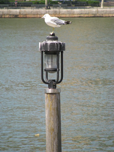
Adult plumage Ring-billed Gull, Larus delawarensis, stands on a lamp on Roosevelt Island, overlooking the East River. Manhattan Island is in the background.
Image: GrrlScientist, 21 August 2008 [larger view].
I went on a little day trip to Roosevelt Island to look at birds and to learn a little about a company known as Verdant Power. Roosevelt Island (formerly Welfare Island, and before that, Blackwell's Island) is a small island that is roughly two miles long located in the middle of the East River, a tidal estuary that flows between Manhattan Island and the Borough of Queens.
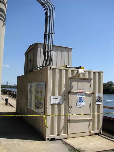
Verdant Power on-site office on the eastern side of Roosevelt Island on the East River.
Image: GrrlScientist 21 August 2008 [larger view].
This is the on-site office for Verdant Power, and it has a poster on the side that describes their research project. Verdant Power is researching and developing new technology to generate ecologically safe electricity;
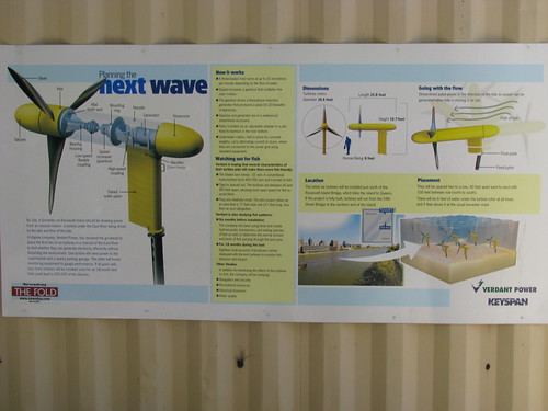
Poster on the side of Verdant Power's on-site office explaining Phase Two of their three phase project to generate electricity using turbines submerged in the East river, which is a tidal estuary.
Image: GrrlScientist 21 August 2008 [larger view].
To generate this power, Verdant Power has designed a series of underwater turbines whose blades are turned by the rapidly flowing water. As these blades turn, they generate mechanical energy which is transformed into electrical energy. The turbines are capable of swinging around like a weatherwave as the water flow changes, so they are always generating energy, regardless of whether the tide is coming in or is flowing out to sea.
Outside Verdant Power's on-site office is a series of buoys. These buoys mark the outermost locaation of the rotating blades of the turbines that generate power, which are located between the buoy and the near shore. As you can see from this image, the water really is moving fast through this channel (when I took this picture, it was flood-tide: the tide was coming in from the ocean);
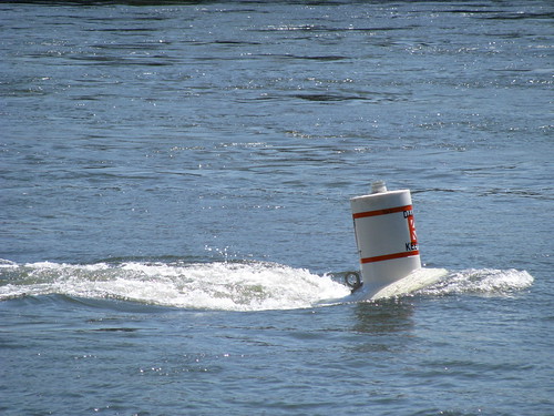
A buoy marking the location of one of the turbines for Verdant Power. These turbines are located underwater and rely on water movement to turn the blades which generates safe, clean electric power. As you can see, the current is very strong.
Image: GrrlScientist 21 August 2008 [larger view].
Looking north from the Verdant Power on-site office towards the suspension bridge, the Robert F. Kennedy Memorial (Triborough) Bridge. The Triborough Bridge carries vehicle traffic between Manhattan and Queens, and you can see a second bridge there, too (the orange one is the Hell's Gate Bridge), which carries railroad traffic. These bridges span Hell's Gate, a tidal channel formed by the confluence of the East River, Harlem River and Bronx Kill;
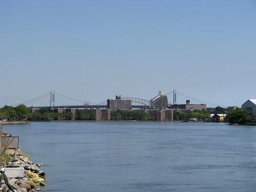
The Robert F. Kennedy Memorial (Triborough) Bridge and the Hell's Gate Bridge. These bridges span Hell's Gate, a tidal channel formed by the confluence of the East River, Harlem River and the Bronx Kill.
Image: GrrlScientist 21 August 2008 [larger view].
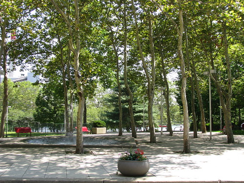
After looking at a few shorebirds and gulls, I walked the length of Roosevelt Island from north to south. Along the way, I stopped to take a few pictures to share with you. This is a park on Main Street, with a water fountain in it. I was tempted to jump in;
This is a picture of the Chapel of the Good Shepherd. It is an historic church located at 543 Main Street on Roosevelt Island;
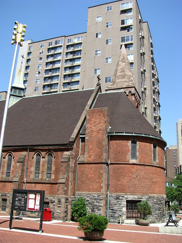
This Chapel was originally an Episcopal chapel, but is now it is known as the Good Shepherd Community Ecumenical Center and is used by various groups. It was built in 1888 and restored in 2003. I liked the juxtaposition of old and new in this image.
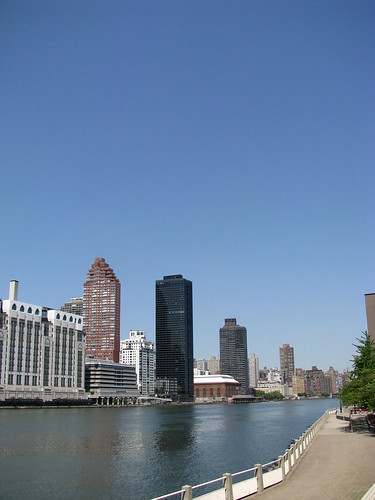
Here is a view of Manhattan's Upper East Side (UES) neighborhood from the park on Roosevelt Island;
Manhattan, as seen from Roosevelt Island. That's the western side of the East River between these two islands.
Image: GrrlScientist 21 August 2008 [larger view].
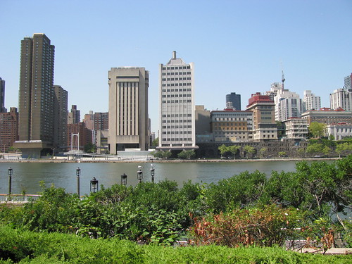
Here's a look northward at Manhattan from Roosevelt Island;
The eastern side of Manhattan, as seen from a park on the west side of Roosevelt Island. The East River lies between these two islands.
Image: GrrlScientist 21 August 2008 [larger view].
The East River is a busy shipping lane, as you will quickly surmise from seeing numerous barges that travel the waterway;
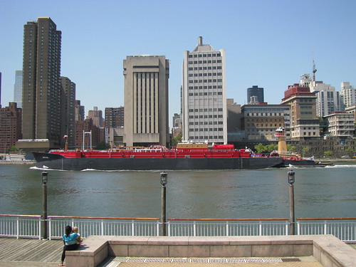
A fast-moving barge going south on the western side of the East River between Roosevelt Island and Manhattan's Upper East Side.
Image: GrrlScientist 21 August 2008 [larger view].
I love tugboats, and here's one with a lovely view of Manhattan behind it;

Tugboat heading north on the western side of the East River between Roosevelt Island and Manhattan's Upper East Side.
Image: GrrlScientist 21 August 2008 [larger view].
Another picture of that tugboat;
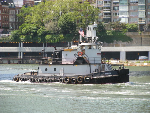
Tugboat heading north on the western side of the East River between Roosevelt Island and Manhattan's Upper East Side.
Image: GrrlScientist 21 August 2008 [larger view].
Here's a lovely view of the Queensboro Bridge with Manhattan in the background;
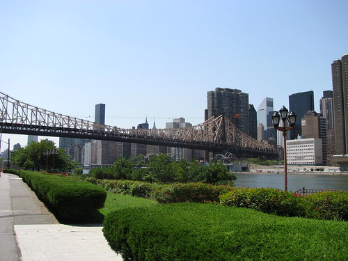
Queensboro Bridge with Manhattan in the background, as seen from Roosevelt Island.
Image: GrrlScientist 21 August 2008 [larger view].
The Queensboro Bridge actually goes over Roosevelt Island, but does not provide access to it. The easiest way to access the island is by the F train, which has the deepest station of all the NYC trains. But instead of returning to Manhattan by subway, I decided to return on the Gondola from Roosevelt Island -- something I've always wanted to do!
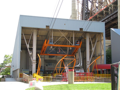
Entrance to the Gondola that goes across the East River between Roosevelt Island and Manhattan.
Image: GrrlScientist 21 August 2008 [larger view].
A view of the cables from inside the gondola itself;
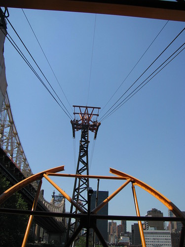
Gondola cables on Roosevelt Island, looking west towards Manhattan. That's the Queensborough Bridge on the left.
Image: GrrlScientist 21 August 2008 [larger view].
A mid-river view of the East River from the gondola, looking north. It only costs $2 to ride the gondola, and even better, you get a free transfer to either the busses or the subways after riding the gondola -- what a bargain!
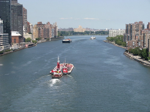
View from the Gondola, looking north along the west side of the East River. Manhattan is on the left in this image, and Roosevelt Island is on the right.
Image: GrrlScientist 21 August 2008. [larger view].
After my gondola ride, I walked across midtown Manhattan from the gondola to the entrance to the west side subways. Along the way, I walked along the southern end of Central Park;
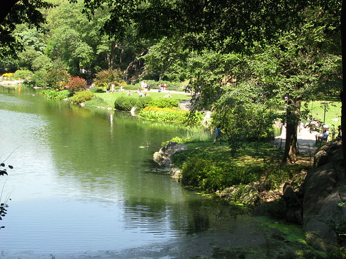
The Pond in the southeastern corner of Central Park at 60th street near 5th Avenue.
Image: GrrlScientist, 21 August 2008 [larger view].
I also stopped to say hello to some carriage horses. This lovely animal is Betty;
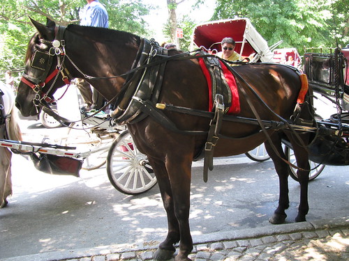
I really enjoyed talking with her driver and seeing the affection they had for each other. They are really a team of co-workers, who clearly depend upon each other for their livelihood.
Here is a view of the Trump Tower with the famous globe in front. The entrance to the subways is below this gross display of wealth;
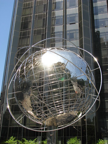
The Trump Tower with the Globe in front at the entrance to the 59th street subway station for the ABCD and 1 lines.
Image: GrrlScientist 21 August 2008 [larger view].
I think Roosevelt Island is one of the few places in Manhattan that I haven't visited. From the looks of it, I should change that.
Roosevelt Island is a kind of utopia from what i could see. it's definitely worth a day trip.
I've never made it over to Roosevelt Island. I used to work on the east side of midtown and sometimes catch the bus home in front of the gondola, but I never rode it over. I'll have to go there sometime.
Thanks for your virtual tour. And you had such a sunny, clear day for doing it!
Very good pictures